Lansingerland

Lansingerland
Lansingerland
Blason de Lansingerland
Héraldique
Drapeau de Lansingerland
Drapeau

Administration
Pays Drapeau : Pays-Bas Pays-Bas
Province Hollande-Méridionale
Code postal 2650-2665
Géographie
Coordonnées 52° 00′ N 4° 30′ E / 52, 4.552° 00′ Nord
       4° 30′ Est
/ 52, 4.5
  
Superficie 5 642 ha = 56,42 km2
  - Terre 5 466 ha = 54,66 km2
  - Eau 176 ha = 1,76 km2
Démographie
Population 47 334 hab.
Densité 817 hab./km2
Localisation
Localisation de Lansingerland

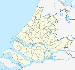
Géolocalisation sur la carte : Hollande-Méridionale

(Voir situation sur carte : Hollande-Méridionale)
Lansingerland

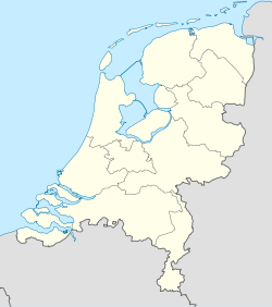
Géolocalisation sur la carte : Pays-Bas

(Voir situation sur carte : Pays-Bas)
Lansingerland

Lansingerland est une nouvelle commune des Pays-Bas de la province de la Hollande-Méridionale. Elle a été créée le 1er janvier 2007, après la fusion volontaire des trois communes de Bergschenhoek, Berkel en Rodenrijs et Bleiswijk.

Lien externe

(nl) Site officiel


Wikimedia Foundation. 2010.

Contenu soumis à la licence CC-BY-SA. Source : Article Lansingerland de Wikipédia en français (auteurs)

Игры ⚽ Нужно решить контрольную?

Regardez d'autres dictionnaires:

  • Lansingerland — Gemeinde Lansingerland Flagge Wappen Provinz Südholland Bürgermeister …   Deutsch Wikipedia

  • Lansingerland — Infobox Settlement name =PAGENAME official name = other name = native name = nickname = settlement type = total type = motto = imagesize = image caption = imagesize = image caption = flag size = image seal size = image shield = Lansingerland… …   Wikipedia

  • Noordeinde (Lansingerland) — 52°0′49″N 4°29′07″E / 52.01361, 4.48528 …   Wikipédia en Français

  • Tempel (Lansingerland) — 52°04′N 4°42′E / 52.067, 4.7 …   Wikipédia en Français

  • Gemeente Lansingerland — Admin ASC 2 Code Orig. name Gemeente Lansingerland Country and Admin Code NL.11.1621 NL …   World countries Adminstrative division ASC I-II

  • Bergschenhoek — 51°59′23″N 4°30′3″E / 51.98972, 4.50083 …   Wikipédia en Français

  • Berkel en Rodenrijs — 51°59′48″N 4°28′27″E / 51.99667, 4.47417 …   Wikipédia en Français

  • Bleiswijk — 52°0′41″N 4°32′19″E / 52.01139, 4.53861 …   Wikipédia en Français

  • Liste der ehemaligen Gemeinden in Südholland — Hierunter folgt eine Liste der ehemaligen südholländischen Gemeinden. Wenn das Gebiet einer aufgehobenen Gemeinde über mehrere Gemeinden verteilt worden ist, ist das Großteil der erstgenannten Gemeinde hinzugefügt. Grenzkorrekturen zwischen… …   Deutsch Wikipedia

  • Kruisweg (Hollande-Méridionale) — 52°2′43″N 4°32′44″E / 52.04528, 4.54556 …   Wikipédia en Français

Share the article and excerpts

Direct link
Do a right-click on the link above
and select “Copy Link”