Frankfort (Kentucky)

Frankfort (Kentucky)
Page d'aide sur l'homonymie Pour les articles homonymes, voir Frankfort.

38° 11′ 50″ N 84° 51′ 47″ W / 38.197222, -84.86305

Frankfort
Image illustrative de l'article Frankfort (Kentucky)
Administration
Pays Drapeau des États-Unis États-Unis
État Kentucky Kentucky
Comté Franklin
Maire Gippy Graham
Code FIPS 21-28900
GNIS 0517517
Site web Consulter
Historique
Municipalité depuis 28 février 1835
Démographie
Population (2000) 27 741 hab.
Densité 713 hab./km²
Géographie
Coordonnées 38° 11′ 50″ Nord
       84° 51′ 47″ Ouest
/ 38.197222, -84.86305
Altitude 155 m
Superficie totale 38,9 km2
· dont terre 38,2 km2 (98,2 %)
· dont eau 0,7 km2 (1,8 %)
Fuseau horaire EST (UTC-5)
Voir la carte administrative
City locator 14.svg
Voir la carte topographique
City locator 14.svg

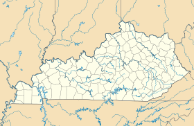
La ville de Frankfort est la capitale de l’État du Kentucky, aux États-Unis. Sa population s’élevait à 27 741 habitants lors du recensement de 2000, estimée à 27 077 habitants en 2006. Frankfort est également le siège du comté de Franklin.

Bien qu'elle ait le statut de capitale, Frankfort est bien modeste comparée à sa voisine Lexington ou à la plus grande ville du Kentucky, Louisville.

Source

Sur les autres projets Wikimedia :


Wikimedia Foundation. 2010.

Contenu soumis à la licence CC-BY-SA. Source : Article Frankfort (Kentucky) de Wikipédia en français (auteurs)

Игры ⚽ Поможем сделать НИР

Regardez d'autres dictionnaires:

  • Frankfort (Kentucky) — Frankfort Das State Capitol von Kentucky in Frankfort Lage in Kentucky …   Deutsch Wikipedia

  • Frankfort, Kentucky — Frankfort (Kentucky) Pour les articles homonymes, voir Frankfort. Frankfort …   Wikipédia en Français

  • Frankfort (Kentucky) — Saltar a navegación, búsqueda Capitolio de Frankfort, Kentucky Frankfort es la capital del estado de Kentucky de Estados Unidos. Capital del condado de Franklin. En el censo del año 2000 contaba con una población de 27.741 habitantes, es por… …   Wikipedia Español

  • Frankfort, Kentucky — Infobox Settlement official name = Frankfort, Kentucky settlement type = City nickname = motto = imagesize = 250px image caption = State Capitol image mapsize = 250px map caption = Location of Frankfort, Kentucky mapsize1 = map caption1 =… …   Wikipedia

  • Frankfort, Kentucky micropolitan area — The Frankfort Micropolitan Statistical Area, as defined by the United States Census Bureau, is an area consisting of two counties in central Kentucky, anchored by the city of Frankfort. As of the 2000 census, the μSA had a population of 66,798… …   Wikipedia

  • Old United States Courthouse and Post Office (Frankfort, Kentucky) — Old U.S. Courthouse and Post Office U.S. National Register of Historic Places …   Wikipedia

  • Old Governor's Mansion (Frankfort, Kentucky) — Old Governor s Mansion U.S. National Register of Historic Places …   Wikipedia

  • Old Stone Tavern (Frankfort, Kentucky) — Old Stone Tavern U.S. National Register of Historic Places …   Wikipedia

  • Liberty Hall (Frankfort, Kentucky) — Infobox nrhp | name =Liberty Hall nrhp type = nhl caption = Liberty Hall in 1986 location= 218 Wilkinson St., Frankfort, Kentucky locmapin = Kentucky area = built =1796 architect= Unknown architecture= Federal added = November 11, 1971cite… …   Wikipedia

  • Church of the Ascension (Frankfort, Kentucky) — Coordinates: 38°11′57.40″N 84°52′45.27″W / 38.199278°N 84.8792417°W / 38.199278; 84.8792417 The Chur …   Wikipedia

Share the article and excerpts

Direct link
Do a right-click on the link above
and select “Copy Link”