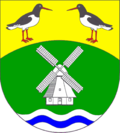
Wrixum
Contenu soumis à la licence CC-BY-SA. Source : Article Wrixum de Wikipédia en français (auteurs)
Regardez d'autres dictionnaires:
Wrixum — Wappen Deutschlandkarte … Deutsch Wikipedia
Wrixum — Infobox Ort in Deutschland image photo = Wappen = Wrixum Wappen.png lat deg = 54 |lat min = 43 lon deg = 8 |lon min = 32 Lageplan = Wrixum in NF.png Bundesland = Schleswig Holstein Kreis = Nordfriesland Amt = Föhr Amrum Höhe = 0 Fläche = 7.55… … Wikipedia
Wrixum — Original name in latin Wrixum Name in other language State code DE Continent/City Europe/Berlin longitude 54.69993 latitude 8.54856 altitude 3 Population 670 Date 2011 04 25 … Cities with a population over 1000 database
Apartments Wrixum auf Föhr -Herrenhof — (Wrixum,Германия) Категория отеля: Адрес: Ohl Dörp 12, 25938 Wr … Каталог отелей
Liste der Kulturdenkmale in Wrixum — In der Liste der Kulturdenkmale in Wrixum sind alle Kulturdenkmale der schleswig holsteinischen Gemeinde Wrixum (Kreis Nordfriesland) und ihrer Ortsteile aufgelistet (Stand: 2007). Wrixum Nr. Zä. Lage Offizielle Bezeichnung Beschreibung Bild 1… … Deutsch Wikipedia
Før — Föhr Satellitenaufnahme Gewässer Wattenmeer Inselgruppe Nordfriesische Inseln … Deutsch Wikipedia
Osterland-Föhr — Föhr Satellitenaufnahme Gewässer Wattenmeer Inselgruppe Nordfriesische Inseln … Deutsch Wikipedia
Osterland Föhr — Föhr Satellitenaufnahme Gewässer Wattenmeer Inselgruppe Nordfriesische Inseln … Deutsch Wikipedia
Osterlandföhr — Föhr Satellitenaufnahme Gewässer Wattenmeer Inselgruppe Nordfriesische Inseln … Deutsch Wikipedia
Föhr — Infobox Islands name = Föhr image caption = Satellite map image size = locator map custom = no native name = Feer, Før native name link = nickname = location = Wadden Sea coordinates = coord|54|43|N|8|30|E|region:DE type:isle archipelago = North… … Wikipedia
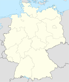

 Allemagne
 Schleswig-Holstein


