Mungindi

Mungindi

28° 58′ 00″ S 149° 00′ 00″ E / -28.966667, 149.00

Mungindi
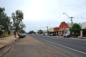
La grand rue de Mungindi
Administration
Pays Drapeau d'Australie Australie
État Nouvelle-Galles du Sud,Queensland
Code postal NSW 2406
Maire Katrina Humphries
Comté de Moree Plains(NSW)
Donna Stewart
Comté de Balonne(QLD)
Géographie
Coordonnées 28° 58′ 00″ Sud
       149° 00′ 00″ Est
/ -28.966667, 149
Démographie
Population 804 hab. (2006)
Localisation
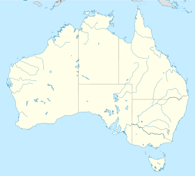
Australia location map.svg
City locator 14.svg
Mungindi

Mungindi (804 habitants) est un village à cheval sur la frontière entre Nouvelle-Galles du Sud et Queensland situé sur la Carnarvon Highway et la rivière Barwon. Il a une adresse postale en Nouvelle-Galles du Sud.

Il est situé à 738 km au nord-ouest de Sydney, à 511 km au sud-ouest de Brisbane et à 122 km de Moree.

Son économie repose sur l'élevage bovin, la culture du coton et des céréales.

Liens externes

Sur les autres projets Wikimedia :


Wikimedia Foundation. 2010.

Contenu soumis à la licence CC-BY-SA. Source : Article Mungindi de Wikipédia en français (auteurs)

Игры ⚽ Поможем решить контрольную работу

Regardez d'autres dictionnaires:

  • Mungindi — New South Wales Main street …   Wikipedia

  • Mungindi — Hauptstraße von Mungindi Staat …   Deutsch Wikipedia

  • Mungindi, New South Wales — Mungindi is a town of approximately 700 persons on the border of New South Wales and Queensland in Moree Plains Shire. It possesses a New South Wales postcode. It sits on the Carnarvon Highway and straddles the Barwon River which is the border… …   Wikipedia

  • Mungindi railway line — Mungindi Line Legend …   Wikipedia

  • Mungindi Bridge — The old bridge over the Barwon River (New South Wales) at Mungindi, New South Wales, looking upstream. The river forms the state border with Queensland on the left bank and New South Wales on the right. Other name(s) Barwon River Bridge …   Wikipedia

  • Mungindi railway line, New South Wales — The Mungindi railway line is a railway line in northern New South Wales, Australia. It branches from the Main North line at the town of Werris Creek and heads north west through the towns of Gunnedah and Narrabri before reaching Moree which for… …   Wikipedia

  • Use the Mungindi glove in the fight — kick an opponent …   Dictionary of Australian slang

  • use the mungindi glove in the fight — Australian Slang kick an opponent …   English dialects glossary

  • New England (New South Wales) — New England New South Wales Mount Duval in New England Population …   Wikipedia

  • Weemelah, New South Wales — Weemelah is a small village (40 people) in Moree Plains Shire, New South Wales, Australia. It is 3 km north off the Carnarvon Highway and 27 km east of Mungindi. The main industry is agriculture. The Country Women s Association of New South Wales …   Wikipedia

Share the article and excerpts

Direct link
Do a right-click on the link above
and select “Copy Link”