Gadong
- Gadong
-
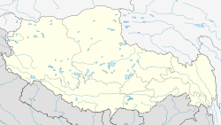
Le monastère de Gadong était un monastère tibétain situé dans la région centrale du Tibet et fondé au XIe siècle par Khache-Sakyashri, un érudit et maître indien. Son nom pourrait venir de Ga, le nom de la montagne surplombant le monastère et de dong, qui signifie « devant » en tibétain. Palden Gyatso indique que Gadong signifie « l'arbre du bonheur ». Peu après la fondation du monastère, la religion Bön a commencé à être rétabli au Tibet, et la plupart des monastères ont céssé d'observer le monachisme bouddhiste. Gadong était un lieu où les moines ont conservé la discipline monastique, et l’on réintroduite au Tibet, d’où son nom de « l'arbre du bonheur ».
Le monastère hébergeait 200 moines. Gadong fut le premier monastère de Palden Gyatso, natif de Panam, un petit village situé à proximité. Il retourna à Gadong en mars 1959 avec Rigzin Tenpa après que des tirs d'obus des Chinois eurent atteint Drepung. C'est dans ce monastère que les deux hommes furent arrêtés. Palden Gyatso passa 33 ans en détention, tandis que Rigzin Tenpa n'a pas survécu. Palden Gyatso rapporte que Gadong a été entièrement détruit.
Articles connexes
Notes et références
Catégories :
- Monastère du bouddhisme tibétain
- Temple bouddhiste au Tibet
Wikimedia Foundation.
2010.
Contenu soumis à la licence CC-BY-SA. Source : Article Gadong de Wikipédia en français (auteurs)
Regardez d'autres dictionnaires:
Gadong — Infobox Settlement official name = Gadong other name = native name = nickname = settlement type = motto = imagesize = image caption = flag size = image seal size = mapsize = map caption = mapsize1 = map caption1 = image dot dot mapsize = dot map… … Wikipedia
Gadong — Original name in latin Gadong Name in other language Gadong, Gadong Xiang, ga dong, ga dong xiang State code CN Continent/City Asia/Urumqi longitude 29.21273 latitude 89.17835 altitude 3864 Population 0 Date 2013 07 05 … Cities with a population over 1000 database
Gadong A, Brunei-Muara — Gadong A is a mukim in the Brunei Muara district of Brunei. It is located in the west facing the South China Sea to the north, bordering Mukim Berakas A to the east, Mukim Gadong B to the south and Mukim Sengkurong to the west.Areas and… … Wikipedia
Gadong B, Brunei-Muara — Gadong B is a mukim in the Brunei Muara district of Brunei. It is located in the central western part of the Brunei Muara district bordering Mukim Gadong A to the north, Mukim Berakas A to the north east, Mukim Kianggeh to the east and south and… … Wikipedia
Gadong-Kloster — Gadong Gompa bzw. das Gadong Kloster (tibet. dga gdong dgon; chinesisch 噶東寺 / 噶东寺 Gadong si; engl. Gadong Monastery) ist ein buddhistisches Kloster der Kadam Schule im Kreis Tölung Dechen von Lhasa des Autonomen Gebiets Tibet… … Deutsch Wikipedia
Malaysia Federal Route 1 — Federal Route 1 Route information Length: 826.6 km (513.6 mi) Existed: 1903 – present … Wikipedia
Brunei-Muara District — Brunei Muara is the northern most district ( daerah in Malay) in Brunei; it is the smallest of Brunei s four districts in term of area but by far the most populous, with over half the country s population. It is the most important and bustling… … Wikipedia
Persekutuan Pengakap Negara Brunei Darussalam — Infobox WorldScouting name =Persekutuan Pengakap Negara Brunei Darussalam image size =140px caption = type = owner = age = headquarters = Jalan Gadong location = Bandar Seri Begawan country = Negara Brunei Darussalam coords = f date =1933 defunct … Wikipedia
Lebuh AMJ — Federal Route 191 Lebuh AMJ Route information Existed: 1994 – present History: Complete … Wikipedia
Brunei-Muara — 4° 54′ N 114° 54′ E / 4.9, 114.9 … Wikipédia en Français
 Chine
Chine Tibet
Tibet