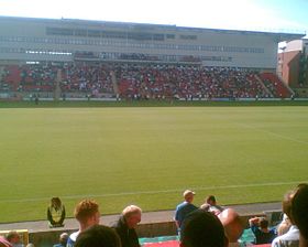
Brisbane Road
Contenu soumis à la licence CC-BY-SA. Source : Article Brisbane Road de Wikipédia en français (auteurs)
Regardez d'autres dictionnaires:
Brisbane Road — Full name Matchroom Stadium, Brisbane Road Location Leyton, London, E10 5NE Built 1937 … Wikipedia
Brisbane Road — Matchroom Stadium Daten Ort England … Deutsch Wikipedia
Brisbane road routes 31-60 — Routes 31 to 40 = Australian road routes table extended state = Queensland route shield = AUSR31.png route type = State Route route number = 31 from locality = Dundas to locality = Brisbane via locality1 = Mount Glorious via locality2 = Mount… … Wikipedia
Brisbane road routes 1-30 — Routes 1 to 10 = Australian road routes table extended state = Queensland route shield = Qld M1.png route number = M1 route type = from locality = Cooroy to locality = Currumbin via locality1 = Caboolture via locality2 = Eagle Farm via locality3 … Wikipedia
Road routes in Brisbane — Brisbane s system of road routes is numbered mostly separately to the rest of the state, and the systems on the Gold Coast and Sunshine Coast. The route numbering is basically distributed as so (with a few exceptions):: Routes 1 6, 13 15: Major… … Wikipedia
Brisbane Tramway Museum — is a transport museum which preserves and displays trams and trolley buses, most of which operated in Brisbane, Queensland, Australia. The museum also has a collection of vehicles and other equipment used in maintaining Brisbane s electric street … Wikipedia
Brisbane central business district — Brisbane CBD Brisbane, Queensland Brisbane CBD from Kangaroo Point … Wikipedia
Brisbane North Institute of TAFE — is one of the largest vocational education and training organisations in Australia, serving more than 30,000 students across six campuses in the northern regions of Brisbane. Campuses are located at Bracken Ridge, Ithaca, Grovely (a neighbourhood … Wikipedia
Brisbane Forest Park — Brisbane Forest Park, which is located on part of the D Aguilar Range, is a large nature reserve on the western boundary of the City of Brisbane, bordering on the Mount Coot tha Reserve. Brisbane Forest Park supports a huge variety of plants and… … Wikipedia
Brisbane Boys’ College — Schulform Jungenschule, Internat Gründung Februar 1902 Ort Toowong Staat … Deutsch Wikipedia
 Angleterre


 Portail de l’architecture et de l’urbanisme
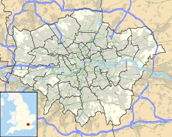
 Portail de Londres
 Portail du football

