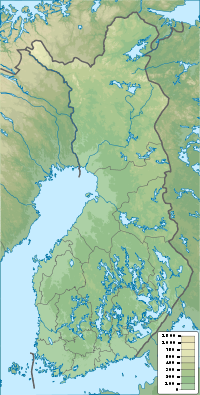
Tyrnävä

Tyrnävä
Tyrnävä
Géographie
Pays Drapeau de Finlande Finlande
Région Ostrobotnie du Nord
Altitude  
 · minimale env 10 m m
 · maximale env 100 m m
Coordonnées 64° 45′ 58″ N 25° 39′ 00″ E / 64.766, 25.6564° 45′ 58″ Nord
       25° 39′ 00″ Est
/ 64.766, 25.65
  
Démographie
Administration
Histoire
Province historique Ostrobotnie
Province Province d'Oulu
Droits de Cité depuis non

Géolocalisation sur la carte : Finlande

(Voir situation sur carte : Finlande)
City locator 4.svg

Tyrnävä est une municipalité du nord-ouest de la Finlande, dans la région d'Ostrobotnie du Nord.

Située en grande banlieue sud d'Oulu (30 km du centre ville), elle connaît comme les autres communes entourant la grande ville du nord du pays une forte croissance de sa population, souvent supérieure à 1.5% par an. Elle s'est également agrandie en annexant en 2001 la petite municipalité de Temmes (700 habitants).

La commune reste largement dépendante de l'agriculture. Son produit phare est la pomme de terre, qui est soit exportée dans tout le reste du pays, soit fermentée et distillée sur place dans l'usine du groupe Shaman Spirits, pour en faire de la vodka.

La commune reste un des bastions du Læstadianisme conservateur en Finlande.

Les municipalités voisines sont Kempele au nord-ouest, Oulu au nord, Muhos à l'est, Liminka au sud et à l'ouest.

Liens externes

Rue Meijeritie, village de Tyrnävä

Wikimedia Foundation. 2010.

Contenu soumis à la licence CC-BY-SA. Source : Article Tyrnävä de Wikipédia en français (auteurs)

Игры ⚽ Поможем написать курсовую

Regardez d'autres dictionnaires:

  • Tyrnava — Tyrnävä 64° 45′ 58″ N 25° 39′ 00″ E / 64.766, 25.65 …   Wikipédia en Français

  • Tyrnävä — is a municipality of Finland.It is located in the province of Oulu and is part of the Northern Ostrobothnia region. The municipality has a population of 5,378 (2003) and covers an area of 489.39 km² of which 3.84 km² is water. The population… …   Wikipedia

  • Tyrnävä — Tyrnävan kunta Wappen Karte Basisdaten …   Deutsch Wikipedia

  • Tyrnävä — Sp Tiùrnevė Ap Tyrnävä L C Suomija …   Pasaulio vietovardžiai. Internetinė duomenų bazė

  • Tyrnava — Original name in latin Tyrnv Name in other language State code FI Continent/City Europe/Helsinki longitude 64.76469 latitude 25.6523 altitude 20 Population 5636 Date 2012 02 20 …   Cities with a population over 1000 database

  • Тюрнявя — фин. Tyrnävä   община Финляндии (АЕ 3 го уровня)  …   Википедия

  • Temmes — Wappen der ehemaligen Gemeinde Temmes Temmes ist ein Ort und eine ehemalige Gemeinde in der finnischen Landschaft Nordösterbotten. 2001 wurde Temmes in Tyrnävä eingemeindet. Temmes liegt am Fluss Temmesjoki rund elf Kilometer südlich des… …   Deutsch Wikipedia

  • List of former municipalities of Finland — This is a list of the former municipalities of Finland.Contents: A B C D E F G H I J K L M N O P Q R S T U V W X Y Z Å Ä Ö NOTOC A *Ahlainen became part of Pori in 1972 *Aitolahti became part of Tampere in 1966 *Akaa was divided in 1946 between… …   Wikipedia

  • Brahestad — Raahen kaupunki Wappen Karte Basisdaten Staat …   Deutsch Wikipedia

  • Kalajoki (Stadt) — Kalajoen kaupunki Wappen Karte Basisdaten Staat …   Deutsch Wikipedia

Share the article and excerpts

Direct link
Do a right-click on the link above
and select “Copy Link”