Kumagaya
- Kumagaya
-
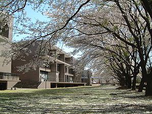
Kumagaya (熊谷市, Kumagaya-shi) est une ville (市, shi) de la préfecture de Saitama, au Japon. La ville a été fondée le 1er avril 1933. Le 1er octobre 2005 les bourgs d'Osato et de Menuma (district d'Osato) ont été intégrés à Kumagaya. La population de la ville est de 203 089 habitants pour une superficie de 159.88 km² (2010).
Kumagaya est desservie par les routes nationales 17, 125, 140 et 407.
Liens externes
Wikimedia Foundation.
2010.
Contenu soumis à la licence CC-BY-SA. Source : Article Kumagaya de Wikipédia en français (auteurs)
Regardez d'autres dictionnaires:
Kumagaya — shi 熊谷市 Geographische Lage in Japan … Deutsch Wikipedia
Kumagaya — Original name in latin Kumagaya Name in other language Kumagai, Kumagaya, gumagaya si, xiong gu shi State code JP Continent/City Asia/Tokyo longitude 36.13333 latitude 139.38333 altitude 30 Population 155813 Date 2012 01 19 … Cities with a population over 1000 database
Kumagaya — ▪ Japan city, Saitama ken (prefecture), Honshu, Japan, on the Ara River. It was named for the 12th century warrior Kumagai Naozane. The city was a post town and silk market during the Tokugawa period (1603–1867) and marked the terminus of… … Universalium
Kumagaya Athletic Stadium — is the new home ground of Japanese football club Omiya Ardija. They play in the highest level of Japanese football, the J League. Japan stadium stub … Wikipedia
Kumagaya, Saitama — Japanese city Name = Kumagaya JapaneseName = 熊谷市 Map Region = Kanto Prefecture = Saitama Prefecture Coords = LatitudeDegrees = 36 LatitudeMinutes = 9 LatitudeSeconds = LongtitudeDegrees = 139 LongtitudeMinutes = 23 LongtitudeSeconds = Area km2 =… … Wikipedia
Kumagaya Station — infobox japan station caption= name= 熊谷 caption= North entrance of Kumagaya station namerom= Kumagaya pref= Saitama district= city= Kumagaya town= address=Tsukuba jaloc=筑波2丁目 open= 1883 close= presentname= line= JR East Jōetsu Shinkansen Nagano… … Wikipedia
Kumagaya-shi — Admin ASC 2 Code Orig. name Kumagaya shi Country and Admin Code JP.34.8304212 JP … World countries Adminstrative division ASC I-II
Kumagaya — ► C. de Japón, en la isla de Hondo, prefectura de Saitama; 152 122 h … Enciclopedia Universal
Tōbu Kumagaya Line — Disused track of the former Tobu Kumagaya Line at Kami Kumagaya Station, November 2011 Overview Type Heavy rail … Wikipedia
Smile Hotel Kumagaya (Formerly:Chisun Inn Kumagaya) — (Kumagaya,Япония) Категория отеля: 3 звездочный отель Адрес … Каталог отелей