Soanindrariny

Soanindrariny

19° 54′ 00″ S 47° 14′ 00″ E / -19.9, 47.233333

Soanindrariny
Administration
Pays Drapeau de Madagascar Madagascar
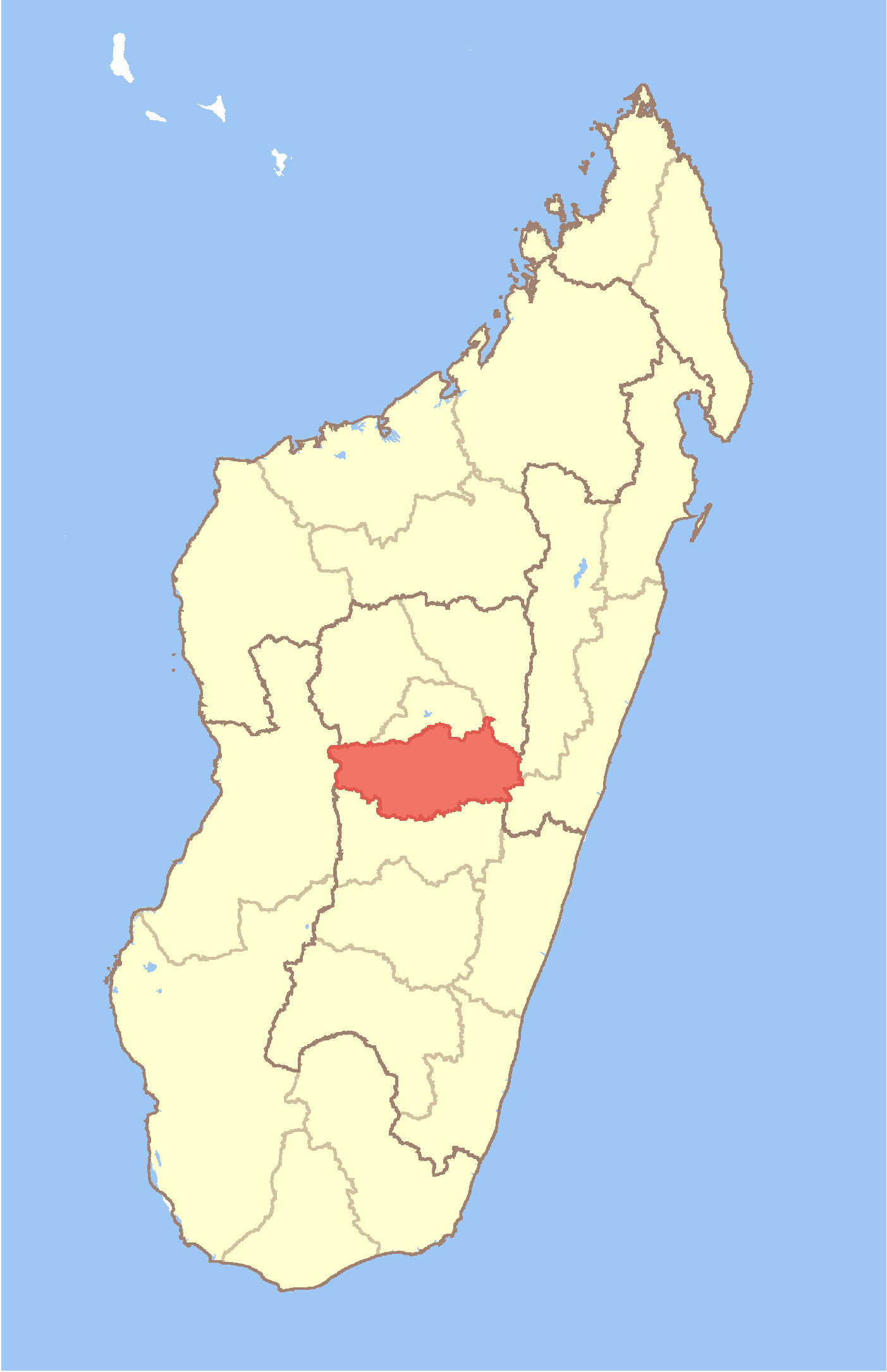
Région Vakinankaratra
Province Antananarivo
District Antsirabe II
Géographie
Coordonnées 19° 54′ 00″ Sud
       47° 14′ 00″ Est
/ -19.9, 47.233333
Altitude 1 788 m
Démographie
Population 21000[1] hab. (est. 2001)
Localisation
Madagascar location map.svg
City locator 14.svg

Soanindrariny est une commune urbaine malgache, située dans la partie sud-est de la région de Vakinankaratra.

Sommaire

Géographie

Démographie

Économie

Notes et références

Voir aussi

Articles connexes


Wikimedia Foundation. 2010.

Contenu soumis à la licence CC-BY-SA. Source : Article Soanindrariny de Wikipédia en français (auteurs)

Игры ⚽ Поможем написать курсовую

Regardez d'autres dictionnaires:

  • Soanindrariny — Infobox Settlement official name = Soanindrariny other name = native name = nickname = settlement type = motto = imagesize = image caption = flag size = image seal size = image shield = shield size = image blank emblem = blank emblem type = blank …   Wikipedia

  • Soanindrariny — Original name in latin Soanindrariny Name in other language State code MG Continent/City Indian/Antananarivo longitude 19.9 latitude 47.23333 altitude 1763 Population 21000 Date 2013 06 06 …   Cities with a population over 1000 database

  • Manjakatompo — Manjakatompo …   Wikipedia

  • Morarano, Ambatolampy — Morarano …   Wikipedia

  • Mangatano — Mangatano …   Wikipedia

  • Manandoana — Manandoana …   Wikipedia

  • Mandrosohasina — Mandrosohasina …   Wikipedia

  • Mahaiza — Mahaiza …   Wikipedia

  • Mandoto — Mandoto …   Wikipedia

  • Mandritsara, Betafo — Mandritsara …   Wikipedia

Share the article and excerpts

Direct link
Do a right-click on the link above
and select “Copy Link”