Podbrđe
- Podbrđe
-
44° 39′ 46″ N 17° 21′ 02″ E / 44.6628, 17.3506
Podbrđe (en serbe cyrillique : Подбрђе) est un village de Bosnie-Herzégovine. Il est situé dans la municipalité de Kotor Varoš, République serbe de Bosnie. Au recensement de 1991, il comptait 775 habitants, dont une majorité de Croates[1].
Démographie
Répartition de la population (1991)
Notes et références
- ↑ a et b (bs)(hr)(sr) Livre : Composition nationale de la population - Résultats de la République par municipalités et localités 1991, Bulletin statistique n°234, Publication de l'Institut national de statistique de Bosnie-Herzégovine, Sarajevo.
Voir aussi
Articles connexes
Liens externes
Catégories :
- Localité de Kotor Varoš
- Localité de Kotor Varoš à majorité croate
Wikimedia Foundation.
2010.
Contenu soumis à la licence CC-BY-SA. Source : Article Podbrđe de Wikipédia en français (auteurs)
Regardez d'autres dictionnaires:
Kotor Varoš — 44° 37′ 01″ N 17° 22′ 18″ E / 44.6169, 17.3717 … Wikipédia en Français
brdo — bȑdo sr <G mn bȓdā> DEFINICIJA 1. prirodno uzvišenje tla relativne visine do 500 m, veće od brijega, a manje od planine 2. a. razg. glomazna hrpa čega [brdo smeća] b. pren. velika količina čega [imamo brdo problema] 3. dio tkalačkog stana… … Hrvatski jezični portal
Križevci — Infobox Settlement official name = Križevci settlement type = Town image caption = image shield = pushpin map caption = Location of Križevci in Croatia subdivision type = Country subdivision name = Croatia subdivision type1 = County subdivision… … Wikipedia
Mníšek pod Brdy — Coordinates: 49°51′59.39″N 14°15′42.33″E / 49.8664972°N 14.2617583°E / 49.8664972; 14.2617583 … Wikipedia
List of settlements in Bosnia and Herzegovina — This is a complete list of settlements in Bosnia and Herzegovina, as recorded by 1991 census, sorted by municipalities. Town of Sarajevo = Sarajevo Centar = • Mrkovići • Nahorevo• Poljine• Radava• Sarajevo (part of settlement)• Vića Sarajevo… … Wikipedia
Kotor-Varoš — Котор Варош Hilfe zu Wappen … Deutsch Wikipedia
Kotor Varos — Kotor Varoš Котор Варош Hilfe zu Wappen … Deutsch Wikipedia
Kotor Varoš — Котор Варош Hilfe zu Wappen … Deutsch Wikipedia
Kotor Varos — Kotor Varoš Kotor Varoš Котор Варош [[Image:|100px|center|Blason]] [[Image:|100px|center|Drapeau]] Blason Drapeau … Wikipédia en Français
Križevci — La cathédrale de Križevci Pays … Wikipédia en Français
 Bosnie-Herzégovine
 République serbe de Bosnie
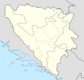
 Podbrđe