Jászladány
- Jászladány
-
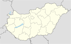
Jászladány est un village et une commune du comitat de Jász-Nagykun-Szolnok en Hongrie.
Géographie
Cette section est vide, insuffisamment détaillée ou incomplète.
Votre aide est la bienvenue !
Histoire
Cette section est vide, insuffisamment détaillée ou incomplète.
Votre aide est la bienvenue !
Catégorie :
- Ville et village du comitat de Jász-Nagykun-Szolnok
Wikimedia Foundation.
2010.
Contenu soumis à la licence CC-BY-SA. Source : Article Jászladány de Wikipédia en français (auteurs)
Regardez d'autres dictionnaires:
Jászladány — (spr. jahßládahnj), Großgemeinde im ungar. Komitat Jazygien Großkumanien Szolnok, an einem Theißarme, (1900) 8957 E … Kleines Konversations-Lexikon
Jászladány — Infobox Settlement settlement type = subdivision type = Country subdivision name = HUN latd= |latm= |lats= |latNS=N longd= |longm= |longs= |longEW=Epushpin pushpin label position = pushpin map caption = pushpin mapsize = timezone=CET utc… … Wikipedia
Jaszladany — Original name in latin Jszladny Name in other language Jaszladany, Jszladny State code HU Continent/City Europe/Budapest longitude 47.36667 latitude 20.16667 altitude 86 Population 6215 Date 2012 01 18 … Cities with a population over 1000 database
Jászladány — Sp Jãsladanis Ap Jászladány L Vengrija … Pasaulio vietovardžiai. Internetinė duomenų bazė
Mezőtúr — Town hall … Wikipedia
Nagyrév — Country Hungary County Jasz Nagykun Szolnok Area – Total 29.79 km2 (11.5� … Wikipedia
Jász-Nagykun-Szolnok County — Infobox Hungarian county name =Jász Nagykun Szolnok region =Northern Great Plain seat = Szolnok area = 5582 population = 399,000 density = 72 cities = 75 This article is about the modern county, for the historical one see Jász Nagykun Szolnok… … Wikipedia
Martfű — Country Hungary County Jász Nagykun Szolnok Area Total 23.08 km2 (8.9 … Wikipedia
Cibakháza — City limit sign (rovas script) Country … Wikipedia
Csataszög — Country Hungary County Jász Nagykun Szolnok Area – Total 11.21 km2 (4.3& … Wikipedia


 Hongrie
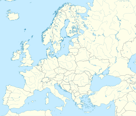

 Jászladány


