Ticonderoga (New York)
Contenu soumis à la licence CC-BY-SA. Source : Article Ticonderoga (New York) de Wikipédia en français (auteurs)
Regardez d'autres dictionnaires:
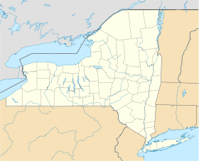
Ticonderoga, New York — Infobox Settlement official name = Ticonderoga, New York settlement type = Town nickname = motto = imagesize = image caption = image |pushpin pushpin label position = pushpin map caption =Location within the state of New York pushpin mapsize =… … Wikipedia
Clark House (Ticonderoga, New York) — Clark House U.S. National Register of Historic Places … Wikipedia
Community Building (Ticonderoga, New York) — Community Building U.S. National Register of Historic Places … Wikipedia
Hancock House (Ticonderoga, New York) — Infobox nrhp | name =Hancock House nrhp type = caption = location= Montcalm and Wicker Sts., Ticonderoga, New York lat degrees = 43 lat minutes = 50 lat seconds = 54 lat direction = N long degrees = 73 long minutes = 26 long seconds = 6 long… … Wikipedia
Ticonderoga (Nueva York) — Ticonderoga Pueblo de los Estados Unidos Fort Ticonderoga en la parte este de Ticonderoga en la Route 74 … Wikipedia Español
New York State Historical Association — The New York State Historical Association is a private, non governmental educational organization founded in 1899 to encourage research, educate general audiences, and start a library and museum of manuscripts, artwork, and other objects… … Wikipedia
Ticonderoga (hamlet), New York — Ticonderoga is a hamlet, in the southeast of the Town of Ticonderoga, in Essex County, New York, United States. The name is derived from a native term for between the two waters. HistoryThe hamlet is located near a portage around the La Chute… … Wikipedia
New York and New Jersey campaign — Part of the American Revolutionary War … Wikipedia
New York Provincial Company of Artillery — Active 1776 Allegiance Province of New York (later State of New York) Type militia Role coastal artillery, field artillery … Wikipedia
New York — New Yorker. 1. Also called New York State. a state in the NE United States. 17,557,288; 49,576 sq. mi. (128,400 sq. km). Cap.: Albany. Abbr.: NY (for use with zip code), N.Y. 2. Also called New York City. a seaport in SE New York at the mouth of… … Universalium
 Pour les articles homonymes, voir Ticonderoga.
 États-Unis
 New York