Kollumerpomp
Contenu soumis à la licence CC-BY-SA. Source : Article Kollumerpomp de Wikipédia en français (auteurs)
Regardez d'autres dictionnaires:
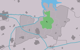
Kollumerpomp — Infobox Settlement official name = Kollumerpomp mapsize = 280px subdivision type = Country subdivision name = flagicon|Netherlands Netherlands subdivision type1 = Province subdivision name1 = flagicon|Friesland Friesland settlement type = Village … Wikipedia
De Westermolen, Kollumerpomp — Westermolen, January 2010. Origin Mill name De Westermolen Mill location … Wikipedia
Apartment Kollumerpomp — (Kollumerpomp,Нидерланды) Категория отеля: Адрес: 9293 LK Kollumerpomp, Ниде … Каталог отелей
Kollumerland en Nieuwkruisland — Héraldique … Wikipédia en Français
Kollum — Gemeinde Kollumerland en Nieuwkruisland Flagge Wappen … Deutsch Wikipedia
Kollumerland c.a. — Gemeinde Kollumerland en Nieuwkruisland Flagge Wappen … Deutsch Wikipedia
Kollumerland en Nieuwkruisland — Gemeinde Kollumerland en Nieuwkruisland Flagge Wappen Provinz Friesland … Deutsch Wikipedia
Villapark Lauwerssee — (Kollumerpomp,Нидерланды) Категория отеля: Адрес: De Rijsdammen 1, 9293 MK Kollumerpomp … Каталог отелей
Kollumerland c.a. — Infobox Settlement official name = Kollumerland c.a. image seal size = 70px mapsize = 280px subdivision type = Country subdivision name = Netherlands subdivision type1 = Province subdivision name1 = Friesland area footnotes = (2006) area total… … Wikipedia
Kinderdijk — Coordinates: 51°53′N 4°38′E / 51.883°N 4.633°E / 51.883; 4.633 … Wikipedia
 Pays-Bas