Ifsar
- Ifsar
-
43° 33′ 32″ N 18° 58′ 07″ E / 43.5589, 18.9686
Avtovac (en serbe cyrillique : Ифсар) est un village de Bosnie-Herzégovine. Il est situé dans la municipalité de Čajniče, République serbe de Bosnie. Au recensement de 1991, il comptait 72 habitants, dont une majorité de Serbes[1].
Démographie
Répartition de la population (1991)
Notes et références
- ↑ a et b (bs)(hr)(sr) Livre : Composition nationale de la population - Résultats de la République par municipalités et localités 1991, Bulletin statistique n°234, Publication de l'Institut national de statistique de Bosnie-Herzégovine, Sarajevo.
Voir aussi
Articles connexes
Liens externes
Wikimedia Foundation.
2010.
Contenu soumis à la licence CC-BY-SA. Source : Article Ifsar de Wikipédia en français (auteurs)
Regardez d'autres dictionnaires:
IFSAR — interferometric synthetic aperture radar … Military dictionary
IfSAR — Interfermetric Synthetic Aperture Radar Contributor: GSFC … NASA Acronyms
Intermap Technologies — Type Public Founded February 25, 1997 key people = Todd Oseth, President and CEO num employees = 140 Headquarters Douglas County, CO USA Website www.intermap.com Intermap Techno … Wikipedia
Čajniče — 43° 33′ 27″ N 19° 04′ 16″ E / 43.5575, 19.0711 … Wikipédia en Français
Ифсар — Деревня Ифсар серб. Ифсар босн. Ifsar Страна … Википедия
Digital elevation model — 3D rendering of a DEM of Tithonium Chasma on Mars A digital elevation model is a digital model or 3 D representation of a terrain s surface commonly for a planet (including Earth), moon, or asteroid created from terrain elevation data. There is… … Wikipedia
Seven Summits — The Seven Summits are the highest mountains of each of the seven continents. Summiting all of them is regarded as a mountaineering challenge, first postulated as such in the 1980s by Richard Bass (Bass et al 1986). Seven Summits definitionsDue to … Wikipedia
Blue Ridge Mountains — Geobox|Range name=Blue Ridge Mountains image caption=Blue Ridge Mountains, Shining Rock Wilderness Area country=United States state=Georgia | state1=North Carolina | state2=Tennessee |state3=Virginia | state4=Maryland | state5=Pennsylvania | |… … Wikipedia
Plateau — For other meanings, see Plateau (disambiguation). Island in the Sky, Canyonlands National Park … Wikipedia
STS-99 — Infobox Space mission mission name = STS 99 insignia = Sts 99 patch.png shuttle = Endeavour launch pad = 39 A launch = February 11, 2000, 12:43 p.m. EST (17:43 UTC) landing = February 22, 2000, 6:23 p.m. EST, KSC, Runway 33 duration = 11 days, 5… … Wikipedia
 Bosnie-Herzégovine
 République serbe de Bosnie
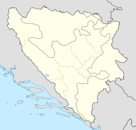
 Ifsar
Ifsar