District de Kohat
- District de Kohat
-
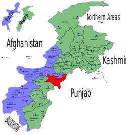
Le district de Kohat est une subdivision administrative de la province Khyber Pakhtunkhwa au Pakistan.
Guerre contre le terrorisme
À cause de sa proximité avec les régions tribales, le district de Kohat est au centre du conflit armé du Nord-Ouest du Pakistan et est régulièrement frappé par des attentats à la bombe.
Voir aussi
Articles connexes
Catégorie :
- District de la province de Khyber Pakhtunkhwa
Wikimedia Foundation.
2010.
Contenu soumis à la licence CC-BY-SA. Source : Article District de Kohat de Wikipédia en français (auteurs)
Regardez d'autres dictionnaires:
Kohat — Cleanup|date=December 2006Kohat (Urdu: کوہاٹ) is a medium sized town in North West Frontier Province of Pakistan. It is the capital of Kohat District. The town centres around a British era fort, various bazaars, and a military cantonment. There… … Wikipedia
Kohat University of Science & Technology — (KUST) is a new public sector university established in 2001 at Kohat District, North West Frontier Province of Pakistan by the governor, Lt. Gen. Syed Iftikhar Hussan Shah. It had four departments/institutes namely: Institute of Information… … Wikipedia
Kohat Division — was an administrative division of the North West Frontier Province of Pakistan, until the reforms of 2000 abolished the third tier of government. At independence in 1947 Kohat was a district of Peshawar Division, however in 1976 it became a… … Wikipedia
Kohat — *Kohat, Stadt u. District des Pendschab im nordwestlichen Indien, im fruchtbaren Kohat Thale im Norden der sogenannten Salzkette, am Teo Fluß gelegen; Bazar u. Moschee; 7–8000 Ew. Die Stadt liegt unweit des Eingangs zum Kohat Paß, durch welchen… … Pierer's Universal-Lexikon
District de Lower Dir — Carte des régions tribales (en bleu) et de Khyber Pakhtunkhwa (en vert) Administration Pays … Wikipédia en Français
District d'Upper Dir — Le district de Dir est en jaune sur la carte. Il fait partie de la province de Khyber Pakhtunkhwa (en vert). Les régions tribales sont en bleu. Administration Pays … Wikipédia en Français
District de Mardan — Le district de Mardan est en jaune sur la carte. Il fait partie de la province de Khyber Pakhtunkhwa (en vert). Les régions tribales sont en bleu. Administration Pays … Wikipédia en Français
District d'Hangu (Pakistan) — District d Hangu Le district d Hangu est en rouge sur la carte. Il fait partie de la province de Khyber Pakhtunkhwa (en vert). Les régions tribales sont en bleu. Administration Pays … Wikipédia en Français
District de Bannu — La province Khyber Pakhtunkhwa (en vert), le district de Bannu en rouge Administration Pays … Wikipédia en Français
District de Charsadda — Le district de Charsadda est en rouge sur la carte. Il fait partie de la province de Khyber Pakhtunkhwa (en vert). Les régions tribales sont en bleu. Administration Pays … Wikipédia en Français
 Pakistan