Wilwerdange
Contenu soumis à la licence CC-BY-SA. Source : Article Wilwerdange de Wikipédia en français (auteurs)
Regardez d'autres dictionnaires:
Wilwerdange — ( lb. Wëlwerdang, de. Wilwerdingen) is a small town in the commune of Troisvierges, in northern Luxembourg. As of 2005, the town has a population of 251 … Wikipedia
Wilwerdange — Este artículo o sección necesita referencias que aparezcan en una publicación acreditada, como revistas especializadas, monografías, prensa diaria o páginas de Internet fidedignas. Puedes añadirlas así o avisar … Wikipedia Español
Luxembourg — This article is about the country in western Europe. For other uses, see Luxembourg (disambiguation). Grand Duchy of Luxembourg Groussherzogtum Lëtzebuerg (Luxembourgish) Grand Duché de Luxembourg (French) … Wikipedia
Troisvierges — Infobox Luxembourg commune name = Troisvierges luxname = Ëlwen arms = Coat of arms troisvierges luxbrg.png LAU2 = 01006 canton = Clervaux district = DiekirchTroisvierges ( lb. Ëlwen, de. Ulflingen) is a commune and town in northern Luxembourg, in … Wikipedia
9th Engineer Battalion (United States) — Infobox Military Unit unit name= 9th Engineer Battalion caption=9th Engineer Battalion coat of arms dates= 1917 1945 1952 1991 1996 present country= United States allegiance= branch= Regular Army type= Engineer battalion role= size= command… … Wikipedia
Kneiff — is a hill in the commune of Troisvierges, in northern Luxembourg. At 560 metres, it is the highest point in the country; it is 1 m taller than Buurgplaatz [ACT (Administration du Cadastre et de la Topographie) Regional Map R1 Clervaux Huldange… … Wikipedia
9. Pionierbataillon (U.S.) — 9. Pionierbataillon Wappen der 9. Pionierbataillon Aufstellung 1917 1945 1952 1991 1996 gegenwartig … Deutsch Wikipedia
Burg-Reuland — Burg Reuland … Deutsch Wikipedia
Kneiff — Der Hügel Kneiff Der Hügel Kneiff stellt mit 560 m die höchste Erhebung von Luxemburg dar. Er liegt in der Gemeinde Troisvierges (dt.: Ulflingen) auf dem Gebiet der Ortschaft Wilwerdange (dt.: Wilwerdingen), im äußersten Norden des… … Deutsch Wikipedia
Ouren (Burg-Reuland) — Burg Reuland DEC … Deutsch Wikipedia
 Wilwerdange
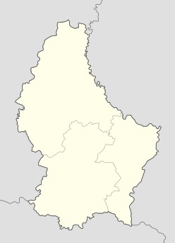

 Luxembourg