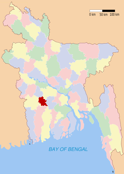
Narail (district)
Contenu soumis à la licence CC-BY-SA. Source : Article Narail (district) de Wikipédia en français (auteurs)
Regardez d'autres dictionnaires:
Narail District — Narail নড়াইল District Location of Narail in Bangladesh … Wikipedia
Narail District — Admin ASC 2 Code Orig. name Narail District Country and Admin Code BD.82.43 BD … World countries Adminstrative division ASC I-II
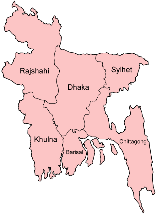
Narail District — noun One of the ten districts in the Khulna Division of Bangladesh … Wiktionary
Narail Sadar Upazila — Narail Sadar নড়াইল সদর Upazila … Wikipedia
Narail (zila) — Coordenadas: 23°08′N 89°30′E / 23.13, 89.5 … Wikipedia Español
Narail Government High School — In 1903, a lawyer Gurudas Bhattacharya founded the Narail English High School . Next it was called as Narail Subdivision High School . At the beginning, there were only Arts related subjects. In 6th decade of 20th century when the school was… … Wikipedia
Lohagara Upazila, Narail — Infobox of upazilas native name = Lohagara locator position = right latd = 23.1833 longd = 89.6625 division name = Khulna Division district = Narail District population as of = 1991 population total = 208248 population density = 716 area total =… … Wikipedia
Bagerhat District — Infobox of BD districts native name = Bagerhat skyline = Bagerhat (Mosque City).jpg skyline size = skyline caption = The historic 60 dome mosque (ষাট গম্বুজ মসজিদ) has become the symbol of Bagerhat District locator position = right latd = 22.66… … Wikipedia
Khulna District — Infobox of BD districts native name = Khulna skyline = skyline size = skyline caption = locator position = right latd = 22.35 longd = 89.30 division name = Khulna Division population as of = 1991 population total = 2,334,285 population density =… … Wikipedia
Magura District — Magura মাগুরা District Location of Magura in Bangladesh … Wikipedia