- Königswartha
-
Königswartha 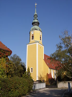
Vue de l'église du village (luthérienne-évangélique)
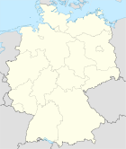

Administration Toponyme officiel Pays  Allemagne
Land  Saxe
SaxeDistrict
(Regierungsbezirk)district de Dresde Arrondissement
(Landkreis)Arrondissement de Bautzen Code communal
(Gemeindeschlüssel)Code postal Indicatif téléphonique Immatriculation Politique Bourgmestre
(Bürgermeister)Georg Paschke Partis au pouvoir CDU Géographie Coordonnées Altitude (NN) 141 m Superficie km2 Démographie Population 3 780 hab. (31 décembre 2010) Densité 80 hab./km2 modifier 
Königswartha (en haut-sorabe: Rakecy) est une commune de Saxe (Allemagne), située dans l'arrondissement de Bautzen, dans le district de Dresde. Sa population était de 3 780 habitants au 31 décembre 2010.
Sommaire
Municipalité
 L'ancienne auberge d'Oppitz, photographie de Günter Rapp en 1987
Plusieurs petits villages ou hameaux, outre Königswartha (2 436 habitants), ont été intégrés à la commune. Il s'agit de
- Caminau, 98 habitants
- Commerau, 276 habitants
- Entenschenke, 27 habitants
- Eutrich, 86 habitants
- Johnsdorf, 61 habitants
- Neudorf, 91 habitants
- Niesendorf, 40 habitants
- Oppitz, 207 habitants
- Truppen, 83 habitants
- Wartha, 382 habitants
Géographie
La commune est traversée par la petite rivière Schwarzwasser, affluent de l'Elster Noire.
Histoire
L'endroit a été mentionné en 1350 pour la première fois par écrit sous le nom de Conigswarte en tant que petite ville ayant acquis ses privilèges de marché. Son nom dérive d'une tour de garde (Wartturm) construite pour surveiller les territoires du roi de Bohême. Elle surveillait en effet la route de Bautzen à Hoyerswerda.
Jusqu'au congrès de Vienne (1815), Königswartha était une ville frontière entre le royaume de Saxe et le royaume de Prusse auquel elle a finalement été intégrée. La frontière passait au nord du village. Deux bornes frontière restaurées en septembre 2008 sont visibles aujourd'hui sur la place du marché.
Königswartha comptait 1 119 habitants en 1884, dont 87% (969) étaient Sorabes.
Monuments
 Vue du château de Königswartha
- Église luthérienne-évangélique
- Château de Königswartha (1780)
Articles connexes
Catégorie :- Ville de Saxe


Wikimedia Foundation. 2010.