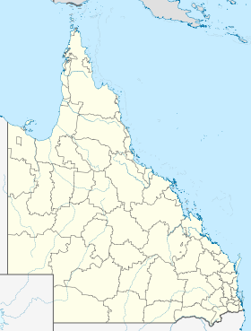
Kingaroy
Contenu soumis à la licence CC-BY-SA. Source : Article Kingaroy de Wikipédia en français (auteurs)
Regardez d'autres dictionnaires:
Kingaroy — Kingaroy, Erdnusssilos Staat … Deutsch Wikipedia
Kingaroy — ▪ Queensland, Australia town, southeastern Queensland, Australia, in the South Burnett area. It originated in 1886 as Kingaroy Paddock, deriving its name from the Aboriginal term kingerroy, meaning “red ant,” and was proclaimed a shire in… … Universalium
Kingaroy — Original name in latin Kingaroy Name in other language KGY, Kingaroy State code AU Continent/City Australia/Brisbane longitude 26.53994 latitude 151.8373 altitude 433 Population 8573 Date 2012 02 28 … Cities with a population over 1000 database
Kingaroy Country Motel — (Kingaroy,Австралия) Категория отеля: 3 звездочный отель Адрес: 38 Knight Str … Каталог отелей
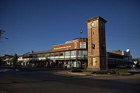
Kingaroy, Queensland — Infobox Australian Place | type = town name = Kingaroy state = qld caption = The peanut silos in Haly Street are the town s tallest structures and most visible landmark. lga = South Burnett Regional Council postcode = 4610 est = pop = 7,620 pop… … Wikipedia
Kingaroy — /kɪŋəˈrɔɪ/ (say kinguh roy) noun a town and shire in south eastern Qld north of Toowoomba; Australia s largest peanut producing area. {Australian Aboriginal; Waga waga (SE Qld) kinjerroy small black ant} …
Shire of Kingaroy — Infobox Australian Place | type = lga name = Shire of Kingaroy state = qld imagesize= 135 caption = Location within Queensland pop = 12,285 pop footnotes = (2006 census) [Census 2006 AUS | id = LGA34350 | name = Kingaroy (S) (Local Government… … Wikipedia
Room Motels Kingaroy — (Kingaroy,Австралия) Категория отеля: 4 звездочный отель Адрес: 76 Youngman Str … Каталог отелей
BIG4 Kingaroy Holiday Park — (Kingaroy,Австралия) Категория отеля: 4 звездочный отель Адрес: 48 Walter … Каталог отелей
PepperTree Cabins, Kingaroy — (Kingaroy,Австралия) Категория отеля: 3 звездочный отель Адрес: 7 Evelyn … Каталог отелей
 Place à Kingaroy
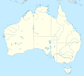
 Kingaroy