- KCLE
-
Aéroport international de Cleveland-Hopkins
Aéroport international de Cleveland-Hopkins
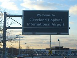
Cleveland Hopkins International Airport
Code AITA
CLECode OACI
KCLEPays  États-Unis
Ville desservie Cleveland (Ohio) Type d'aéroport public Gestionnaire City of Cleveland Altitude 241 m 791 ft Latitude 41° 24' 42" N Longitude 81° 50' 59" O Superficie 769 ha Pistes Direction Longueur Surface mètres pieds 6L/24R 2 743 9 000 béton 6R/24L
Fermé2 743 9 000 béton 6C/24C 2 163 7 096 béton 10/28 1 834 6 017 asphalte/béton Catégories Aéroports • Aéroports par pays Listes Liste des aéroports • Par code AITA
Par nombre de passagersL’Aéroport international de Cleveland-Hopkins (code AITA : CLE, code OACI : KCLE) est un aéroport public situé à 14 kilomètres (9 miles) au sud-ouest du central business district de Cleveland, une ville dans le comté de Cuyahoga, en Ohio, aux États-Unis. L'aéroport se trouve juste à l'intérieur des limites de la ville, et c'est le plus grand dans l'État de l'Ohio.
Sommaire
Histoire
L'aéroport (CLE) a été fondé en 1925, devenant ainsi le premier aéroport appartenant à une municipalité aux États-Unis. Il a été le lieu de grandes premières pour les aéroports avec la première tour de contrôle pour le trafic aérien, le premier système d'éclairage des pistes, cela dès 1930. Plus tard, en 1968, il devient le premier aéroport américain à être directement connecté à un système de métro local ou régional. CLE a été nommé d'après son fondateur, William R. Hopkins, pour son 82e anniversaire en 1951.
CLE a accueilli 11,3 millions de passagers en 2006 et surpassera ce total en 2007 avec un taux de croissance de 1.5 %. Il est une plateforme de correspondance (hub) importante pour la compagnie Continental Airlines et sa filiale ExpressJet. Continental Airlines exploite 2 lignes quotidiennes vers l'Europe depuis Cleveland: Londres-Gatwick et, depuis mai 2008, Paris CDG. Le Cleveland Hopkins International Airport et l'aéroport de Burke Lakefront constituent le Cleveland Airport System exploité par le City of Cleveland's Department of Port Control.
Installations
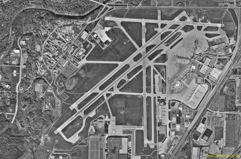
Le Cleveland Hopkins International Airport couvre une superficie de 769 hectares, avec trois pistes:
- Piste 6R/24L: 2,743 x 46 mètres, surface: béton
- Depuis le 7/2007, cette piste est fermée et il est possible qu'elle soit étendue à 3,034 mètres (9,956 pieds).
- Piste 6L/24R: 2,743 x 46 mètres, surface: béton
- Piste 10/28: 1,834 x 46 mètres, surface: asphalte/béton
L'ancienne piste parallèle, maintenant désigné Piste 6C/24C, a une longueur de 2,163 mètres et une largeur de 46 mètres. Ses extrémités sont éclairés avec la marque "X" afin d'empêcher son utilisation par inadvertance, même si elle est en cours d'utilisation alors que la 6R/24L est temporairement hors service.
Galerie
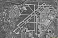
Vue satellitaire (2000)
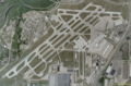
Image satellite récente
Notes et références de l'article
Voir aussi
Articles connexes
Liens externes
Catégories : Aéroport américain | Cleveland - Piste 6R/24L: 2,743 x 46 mètres, surface: béton


Wikimedia Foundation. 2010.