- Interstate 15
-
Interstate 15 
Longueur 2307 km (1433 mi) Ouverture 1957 Direction sud-ouest / nord Extrémité sud-ouest  I-8 à San Diego, CA
Intersections  I-10 à Ontario, CA
 I-40 à Barstow, CA
 US 95 à Las Vegas, NV
 I-70 près de Cove Fort, UT
 I-80 à Salt Lake City, UT
 I-84 à Ogden, UT et Tremonton, UT
 I-86 à Pocatello, ID
 I-90 près de Butte, MT
Extrémité nord ALB 4 à la frontière canado-américaine, près de Sweetgrass, MT Réseau Interstate highway L'Interstate 15 (abrégé en I-15) est une autoroute inter-États américaine parcourant le Montana, l'Idaho, l'Utah, l'Arizona, le Nevada, et la Californie. C'est un axe majeur du trafic routier de ce dernier État, ainsi que la première route de transport de l’agglomération de Salt Lake City. L'autoroute permet aussi de relier la Californie du Sud à Las Vegas, et est ainsi très fréquentée par les touristes qui s’y rendent. Un projet de construction de train à sustentation magnétique suivant le tracé de l'I-15 entre la Californie et Las Vegas est à l'étude[1].
Sommaire
Distances
Milles km État 287 462 Californie 124 200 Nevada 29 47 Arizona 401 645 Utah 196 315 Idaho 396 637 Montana 1,433 2,307 Total Villes principales traversées
- San Diego, Californie
- Riverside, Californie
- San Bernardino, Californie
- Los Angeles, Californie (par l'Interstate 10)
- Barstow, Californie
- Las Vegas, Nevada
 L'Interstate 15 dans la Vallée d'Ivanpah.
- St. George, Utah
- Provo, Utah
- Salt Lake City, Utah
- Ogden, Utah
- Pocatello, Idaho
- Idaho Falls, Idaho
- Butte, Montana
- Helena, Montana
- Great Falls, Montana
Références
Voir aussi
Liens externes
- http://www.ihoz.com/interstates.html
- http://www.dot.ca.gov/dist11/facts/I-15managed.pdf
- 2005 Rand McNally "The Road Atlas 2005"
- Interstate 15 sur la page de Larry's Phat
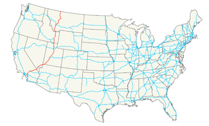
Autoroutes inter-États (principales en rose) 
4 5 8 10 12 15 16 17 19 20 22 24 25 26 27 29 30 35 37 39 40 43 44 45 49 55 57 59 64 65 66 68 69 70 71 72 73 74 75 76 (W) 76 (E) 77 78 79 80 81 82 83 84 (W) 84 (E) 85 86 (W) 86 (E) 87 88 (W) 88 (E) 89 90 91 93 94 95 96 97 99 (238) H-1 H-2 H-3 Autres A-1 A-2 A-3 A-4 PRI-1 PRI-2 PRI-3 Catégorie :- Autoroute inter-États américaine


Wikimedia Foundation. 2010.