Hoogblokland
Contenu soumis à la licence CC-BY-SA. Source : Article Hoogblokland de Wikipédia en français (auteurs)
Regardez d'autres dictionnaires:
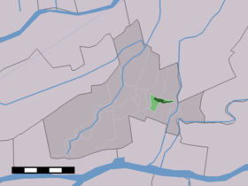
Hoogblokland — Dutch town locator maps mun town caption = The village centre (dark green) and the statistical district (light green) of Hoogblokland in the municipality of Giessenlanden.Hoogblokland (coord|51|52|N|4|59|E|type:city(935)) is a village in the… … Wikipedia
Anciennes communes de la Hollande-Méridionale — En 1812, la province néerlandaise de la Hollande Méridionale comptait 148 communes. En 1820, après l annulation des modifications faites sous l Empire français, ce nombre était de nouveau porté à 251. Depuis 2010, il n y en a plus que 78.… … Wikipédia en Français
Giessenlanden — Héraldique … Wikipédia en Français
Liste aller niederländischen Gemeinden A–L — In diese Liste werden alle Gemeinden, die auf dem Gebiet der jetzigen Niederlande bestehen oder bestanden haben, aufgenommen. Die Liste beginnt im Jahr 1805/10. Vor 1830 können die Angaben unvollständig sein. Kleinere Grenzkorrekturen oder… … Deutsch Wikipedia
Arkel (Hollande-Méridionale) — Pour les articles homonymes, voir Arkel. 51°51′50″N 4°59′40″E / … Wikipédia en Français
Hoornaar — 51°52′36″N 4°56′49″E / 51.87667, 4.94694 … Wikipédia en Français
Noordeloos — 51°54′15″N 4°56′30″E / 51.90417, 4.94167 … Wikipédia en Français
Schelluinen — 51°50′33″N 4°55′33″E / 51.8425, 4.92583 … Wikipédia en Français
Giessenlanden — Infobox Settlement official name = Giessenlanden flag size = 120x100px image shield = Giessenlanden wapen.png shield size = 120x100px mapsize = 280px subdivision type = Country subdivision name = Netherlands subdivision type1 = Province… … Wikipedia
List of places in the Netherlands — This is an alphabetical list of places (cities, towns, villages) in the Netherlands. Lists per province can be found at:* List of towns in Groningen * List of towns in Friesland * List of towns in Drente * List of towns in Overijssel * List of… … Wikipedia
 Pays-Bas