Grape Creek
Contenu soumis à la licence CC-BY-SA. Source : Article Grape Creek de Wikipédia en français (auteurs)
Regardez d'autres dictionnaires:
Grape Creek — Grape Creek, TX U.S. Census Designated Place in Texas Population (2000): 3138 Housing Units (2000): 1219 Land area (2000): 17.214974 sq. miles (44.586575 sq. km) Water area (2000): 0.000000 sq. miles (0.000000 sq. km) Total area (2000): 17.214974 … StarDict's U.S. Gazetteer Places
Grape Creek, TX — U.S. Census Designated Place in Texas Population (2000): 3138 Housing Units (2000): 1219 Land area (2000): 17.214974 sq. miles (44.586575 sq. km) Water area (2000): 0.000000 sq. miles (0.000000 sq. km) Total area (2000): 17.214974 sq. miles… … StarDict's U.S. Gazetteer Places
Grape Creek — Original name in latin Grape Creek Name in other language State code US Continent/City America/Chicago longitude 31.57932 latitude 100.5476 altitude 607 Population 3154 Date 2011 05 14 … Cities with a population over 1000 database
Grape Creek (Texas) — Grape Creek Lugar designado por el censo de los Estados Unidos … Wikipedia Español
Grape Creek-Pulliam Independent School District — is a public school district in north central Tom Green County, Texas (USA) that serves the community of Grape Creek and surrounding areas.Grape Creek Pulliam ISD has three campuses Grape Creek High (Grades 9 12), Grape Creek Middle (Grades 6 8),… … Wikipedia
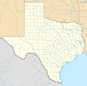
Grape Creek, Texas — Infobox Settlement official name = Grape Creek, Texas settlement type = CDP nickname = motto = imagesize = image caption = image |pushpin pushpin label position =left pushpin map caption =Location within the state of Texas pushpin mapsize =… … Wikipedia
Silver Creek, New York — Infobox Settlement official name = Silver Creek, New York settlement type = Village nickname = motto = imagesize = image caption = image |pushpin pushpin label position = pushpin map caption =Location within the state of New York pushpin mapsize … Wikipedia
Moby Grape — Columbia Records promotional photo, 1967. (Left to Right) Skip Spence, Jerry Miller, Bob Mosley, Peter Lewis, Don Stevenson Background information Origin San … Wikipedia
Moby Grape — Este artículo o sección sobre música necesita ser wikificado con un formato acorde a las convenciones de estilo. Por favor, edítalo para que las cumpla. Mientras tanto, no elimines este aviso puesto el 21 de septiembre de 2010. También puedes… … Wikipedia Español
Moby Grape — ist eine US amerikanische Rockgruppe, die in den 1960er Jahren gegründet wurde und die sich bis heute sporadisch zu Live Konzerten zusammenfindet. Alle fünf Gründungsmitglieder waren sowohl Songschreiber als auch Sänger, die stilistisch Elemente… … Deutsch Wikipedia
 États-Unis
 Texas
Texas