Gap of Dunloe
- Gap of Dunloe
-
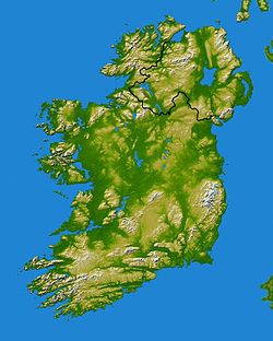
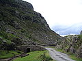
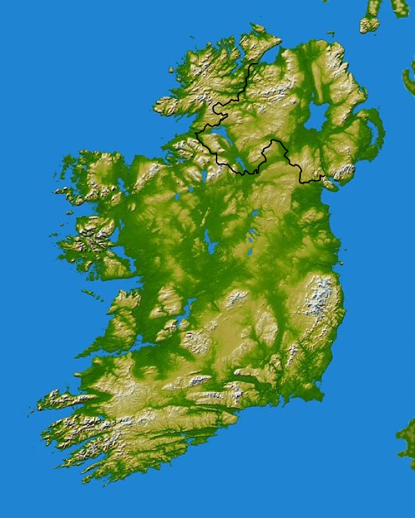
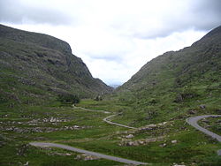
Gap of Dunloe ou Bearna an Choimín est un col entre les Macgillycuddy's Reeks et les Purple Mountains à l'ouest de Killarney, comté de Kerry, Irlande. Il commence à Kate Kearney's Cottage et se termine avec une descente dans la Black Valley, à une distance d'environ 11 km.
Il y a 5 petits lacs depuis le Kate Kearney's Cottage : Coosaun Lough, Black Lake, Cushnavally Lake, Auger Lake, et Black Lough. Ces lacs sont reliés par la rivière Loe (qui a donné son nom au col). Entre le premier et le deuxième lac, on passe sur un vieux pont de pierre appelé Wishing Bridge en raison des vœux qui se réaliseraient s'ils y sont prononcés.
Galerie
Liens externes
Wikimedia Foundation.
2010.
Contenu soumis à la licence CC-BY-SA. Source : Article Gap of Dunloe de Wikipédia en français (auteurs)
Regardez d'autres dictionnaires:
Gap of Dunloe — The Gap of Dunloe ( ga. Bearna an Choimín) is a narrow pass between Macgillycuddy s Reeks and the Purple Mountains near Killarney, Ireland. It begins at Kate Kearney s Cottage and ends with a descent into The Black Valley, a distance of… … Wikipedia
Dunloe Castle Hotel Killarney (Killarney) — Dunloe Castle Hotel Killarney country: Ireland, city: Killarney (Lakes of Killarney) Dunloe Castle Hotel Killarney Dunloe Castle Hotel is situated in the midst of a fascinating Park landscape, near the famous dunloe gap, and has Castle ruins in… … International hotels
Ring of Kerry — The Ring of Kerry is a tourist trail in County Kerry, south western Ireland. The route covers the 170 km circular road (N70, N71 and R562), starting from Killarney, heading around the Iveragh Peninsula and passing through Kenmare, Sneem,… … Wikipedia
Wayside B&B — (Бофорт,Ирландия) Категория отеля: 3 звездочный отель Адрес: Gap Of Dunloe, Бофорт, Ирл … Каталог отелей
The Black Valley — in County Kerry, is a remote location in the Macgillycuddy s Reeks situated south of the Gap of Dunloe and north of Moll s Gap. The valley is also part of the Kerry Way, a walkers version of the Ring of Kerry beginning and ending in Killarney.The … Wikipedia
Killarney — Infobox Irish Place name = Killarney gaeilge = Cill Airne crest motto = map pin coords = left: 90px; top: 75px north coord = 52.0588 west coord = 9.5072 irish grid = V969909 area = elevation = 50 m province = Munster county = County Kerry town… … Wikipedia
Rock formations in Ireland — Ireland= *Beara Peninsula, Bantry, County Cork *Blarney Stone *Skellig Rocks, Iveragh Peninsula, County Kerry *Gap of Dunloe, Killarney, County Kerry *Tory Island, County Donegal *Achill Island, County Mayo … Wikipedia
Purple Mountains — The Purple Mountains are a small mountain range situated in central Kerry in Ireland, close to the town of Killarney. There are only a dozen or so peaks in the range, of which only three are named: Purple Mountain, 832m; Tomies Mountain, 735m;… … Wikipedia
Cnoc na Péiste — and part of Loch Coimín Piast are in the top left of the picture … Wikipedia
Cnoc na Péiste — Géographie Altitude 988 m Massif Macgillycuddy s Reeks Coordonnées … Wikipédia en Français
 Irlande