- Front Range Urban Corridor
-
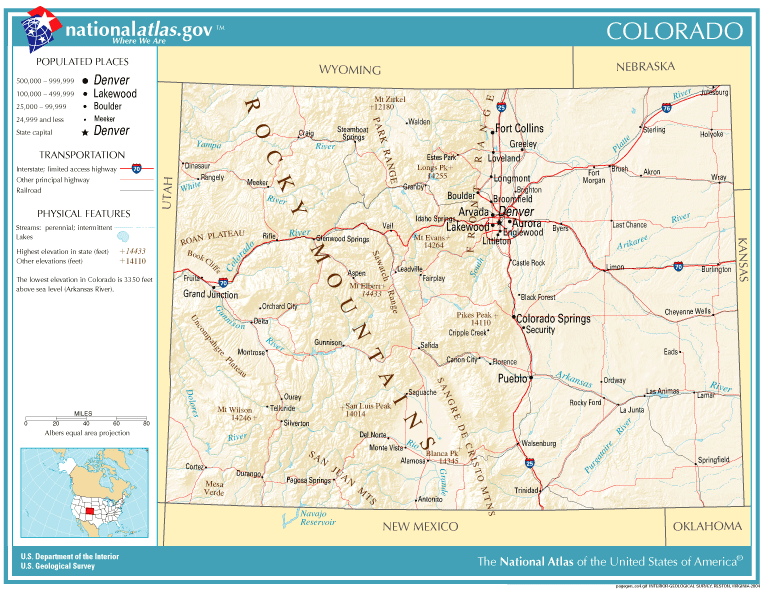
 Carte routières du Colorado.
 Carte des densités de population du Colorado.
Le Front Range Urban Corridor (Corridor Urbain du Front Range) est une région urbaine qui s'étend immédiatement à l'est du Front Range, une cordillère des montagnes Rocheuses, dans les états américains du Colorado et du Wyoming. Selon le bureau de recensement des États-Unis, la population était estimée en 2007 à 4 175 239 habitants ce qui représente une augmentation de 13,21% depuis le recensement de 2000[1].
Le corridor urbain s'étend le long de l'Interstate 25, de Pueblo (Colorado) au sud jusqu'à Cheyenne (Wyoming) au nord. Il englobe la zone métropolitaine Denver-Aurora, et les zones métropolitaines de Colorado Springs, Boulder, Fort Collins-Loveland, Greeley, Pueblo, Cheyenne et Cañon City.
La partie allant de Pueblo à Fort Collins est appelée Colorado Front Range.
Aires urbaines du Front Range Urban Corridor
Front Range Urban Corridor Zone statistique Pop. 2007 Comté Pop. 2007 Pop. 2000 Δ Pop. Denver-Aurora 2,464,866 Denver 588349 554636 +6,08% Comté d'Arapahoe (Colorado) 545089 487967 +11,71% Comté de Jefferson (Colorado) 529354 527056 +0,44% Comté d'Adams (Colorado) 422495 363857 +16,12% Comté de Douglas (Colorado) 272117 175766 +54,82% Comté de Broomfield (Colorado) 53691 0 - Comté d'Elbert (Colorado) 22720 19872 +14,33% Comté de Park (Colorado) 17004 14523 +17,08% Comté de Clear Creek (Colorado) 8956 9322 -3,93% Comté de Gilpin (Colorado) 5091 4757 +7,02% Colorado Springs 609096 Comté d'El Paso (Colorado) 587272 516929 +13,61% Comté de Teller (Colorado) 21824 20555 +6,17% Boulder 290262 Comté de Boulder (Colorado) 290262 291288 -0,35% Fort Collins-Loveland 281,620 Comté de Larimer (Colorado) 281620 251494 +11,98% Greeley 243750 Comté de Weld (Colorado) 243750 180936 +34,72% Pueblo 152081 Comté de Pueblo (Colorado) 152081 141472 +7,50% Cheyenne 86353 Comté de Laramie (Wyoming) 86353 81607 +5,82% Cañon City 47211 Comté de Fremont (Colorado) 47211 46145 +2,31% Total 4175239 3688182 +13,21% Notes et références
- (en)Annual Estimates of the Population of Combined Statistical Areas: April 1, 2000 to July 1, 2007, United States Census Bureau, Population Division, 27-03-2008. Consulté le 27-03-2008


Wikimedia Foundation. 2010.