Farringdon
- Farringdon
-
Farringdon (métro de Londres)
| Farringdon |
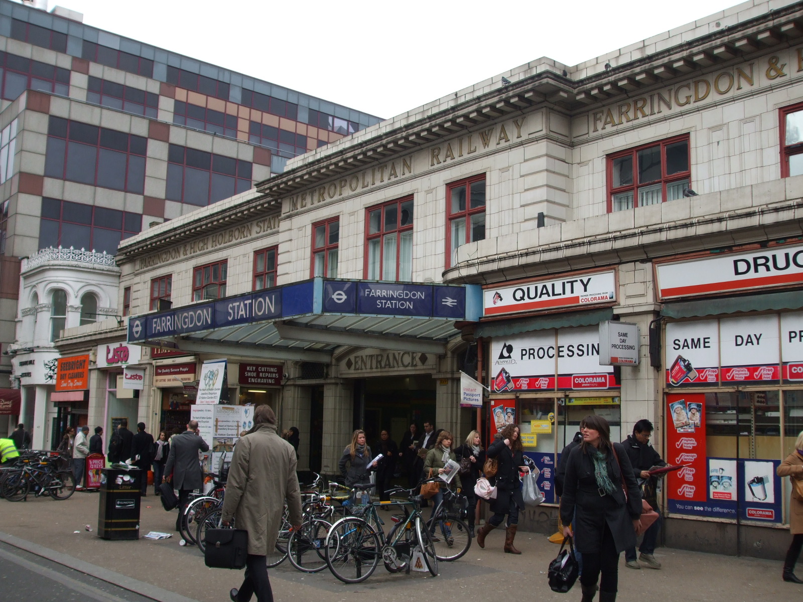
L'entrée de la station |
| Localisation |
| District de Londres |
Islington |
| Quartier |
Paddington |
| Gestion et exploitation |
| Lignes |
 Circle Circle  Hammersmith & City Hammersmith & City  Metropolitan Metropolitan |
| Caractéristiques |
| Quais |
4 |
| Transit annuel |
14,392 millions (2004)
18,285 millions (2007) |
| Zone |
1 |
| Historique |
| Mise en service |
1863 |
Farringdon est le nom donné a une station du Métro de Londres, située à Clerkenwell.
C'est l'une des stations les plus anciennes du métro londonien, puisqu'elle fut l'un le terminus est de la première ligne de métro : celle du Metropolitan Railway inaugurée le 10 janvier 1863, qui reliait Farrington à Paddington, 6 km plus à l'ouest. Elle portait alors le nom de Farringdon Street.
Deux ans plus tard, la Metropolitan Railway déplaça la station à son emplacement actuel, lorsque la ligne fut prolongée sur Moorgate le 23 décembre 1865. Puis, elle prit le Farringdon and High Holborn le 26 janvier 1922, et enfin tout simplement Farringdon le 21 avril 1936.
Voir aussi
Articles connexes
 Portail du chemin de fer
 Portail de Londres
 Portail des transports en commun
Catégories : Circle line | Hammersmith & City line | Metropolitan line | Station du métro de Londres
Wikimedia Foundation.
2010.
Contenu soumis à la licence CC-BY-SA. Source : Article Farringdon de Wikipédia en français (auteurs)
Regardez d'autres dictionnaires:
Farringdon — may refer to:*Farringdon, London **Farringdon Within and Farringdon Without are wards in the City of London **Farringdon station, a railway station in the London Borough of Islington **Farringdon Road, a Central London road *Farringdon, Devon… … Wikipedia
Farringdon — ist eine Vorortsiedlung von Sunderland im Metropolitan County Tyne and Wear in England. In den 1960er Jahren erwarb die Stadtverwaltung von Sunderland bis dahin landwirtschaftlich genutzte Gründe am Stadtrand und errichtete dort die Wohnsiedlung… … Deutsch Wikipedia
Farringdon — Farringdon, Stadt in der englischen Grafschaft Berkshire, unweit der Great Westerneisenbahn (London Bristol), starke Schweinezucht, Handel mit Schweinefleisch, Speck u. Getreide; 2500 Ew … Pierer's Universal-Lexikon
Farringdon Road — is a road in Clerkenwell, Central London. Its construction, which took almost 20 years between the 1840s and the 1860s, is considered one of the greatest urban engineering achievements of the nineteenth century. Not only was it one of the first… … Wikipedia
Farringdon, Devon — Farringdon is a village in the district of East Devon in the county of Devon, England.The village is twinned with Secqueville en Bessin, Normandy, France.References*CoorOS … Wikipedia
Farringdon, London — infobox UK place official name= Farringdon latitude= 51.520905 longitude= 0.103675 london borough= Islington constituency westminster= Islington South and Finsbury post town= LONDON postcode area= EC postcode district= EC1 dial code= 020 os grid… … Wikipedia
Farringdon Without — infobox UK place official name= Ward of Farringdon Without map type= Greater London country= England region= London london borough= City of London latitude= 51.51627 longitude= 0.10911 os grid reference= TQ313814 post town= LONDON postcode area=… … Wikipedia
Farringdon, Sunderland — Infobox UK place official name= Farringdon country= England region= North East England static static image caption= Allendale Road, Farringdon map type= Tyne and Wear population= 5,100 latitude= 54.8732 longitude= 1.4238 post town= SUNDERLAND… … Wikipedia
Farringdon station — Infobox London station| name = Farringdon | | owner=London Underground | manager = London Underground | zone = 1 | locale = Clerkenwell | borough = London Borough of Islington | start=1863 | platforms= 4 | latitude = 51.520 longitude = 0.1053… … Wikipedia
Farringdon Within — infobox UK place official name= Ward of Farringdon Within map type= Greater London country= England region= London london borough= City of London latitude= 51.51438 longitude= 0.10343 os grid reference= TQ317812 post town= LONDON postcode area=… … Wikipedia
 Métro de Londres