Ettal
- Ettal
-

Pour l’article homonyme, voir Ettal (Micronésie).
Ettal est une commune de Haute-Bavière à 10 km au nord de Garmisch-Partenkirchen et à environ 8 km au sud-est d'Oberammergau dans le district de Garmisch-Partenkirchen. Elle compte aujourd'hui environ 850 habitants et se compose d'Ettal et de Graswang, (ou se situe le château de Linderhof), Dickelschwaig et Rahm. La municipalité fait partie de la communauté administrative d'Unterammergau. L'abbaye bénédictine d'Ettal est située sur le territoire de la commune.
En 1922, le compositeur russe Prokofiev s'est retiré pour dix-huit mois à Ettal pour y terminer la composition de son opéra l'Ange de feu.
Wikimedia Foundation.
2010.
Contenu soumis à la licence CC-BY-SA. Source : Article Ettal de Wikipédia en français (auteurs)
Regardez d'autres dictionnaires:
Ettal — Ettal, Pfarrdorf im Landgericht Werdenfels in Oberbaiern, bei dem Flusse Murnau; Wallfahr skirche, Marmorbrüche, ehemalige Benedictinerabtei; in der Nähe der Berg Ettaler Mandl. Das Kloster wurde 1332 von Kaiser Ludwig IV. gegründet, u. Anfangs… … Pierer's Universal-Lexikon
Ettal — Ettal, Dorf im bayr. Regbez. Oberbayern, Bezirksamt Garmisch, hat eine Wallfahrtskirche (mit ausgezeichneter Orgel), ein ehemaliges Benediktinerkloster (1332 gestiftet, 1803 aufgehoben, seit 1899 wieder eröffnet) und (1900) 528 Einw. In der Nähe… … Meyers Großes Konversations-Lexikon
Ettal — Ettal, Dorf im bayr. Reg. Bez. Oberbayern, im Ammergau, am südl. Fuße des Laberberges (höchster Gipfel das Ettaler Mandl, 1641 m), (1900) 528 E., Benediktinerabtei (1904 wieder eröffnet). – Vgl. Seidel (1890) … Kleines Konversations-Lexikon
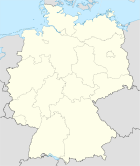
Ettal — Wappen Deutschlandkarte … Deutsch Wikipedia
Ettal — Infobox German Location Name = Ettal Art = Stadt image photo = imagesize = image caption = Wappen = Wappen von Ettal.png lat deg = 47 |lat min = 34 lon deg = 11 |lon min = 6 Lageplan = Bundesland = Bayern Regierungsbezirk = Oberbayern Landkreis … Wikipedia
Ettal — 1 Original name in latin Ettal Name in other language Ettal State code DE Continent/City Europe/Berlin longitude 47.56667 latitude 11.1 altitude 903 Population 814 Date 2011 04 25 2 Original name in latin Ettal Name in other language State code… … Cities with a population over 1000 database
Ettal — Ẹttal, Gemeinde im Landkreis Garmisch Partenkirchen, Oberbayern, 900 m über dem Meeresspiegel, am Fuß des Ettaler Mandls (1 633 m über dem Meeresspiegel), 1000 Einwohner; Fremdenverkehr. Stadtbild: Kaiser Ludwig der Bayer gründete 1330 ein … Universal-Lexikon
Ettal — Sp Ètalis Ap Ettal L PR Vokietija … Pasaulio vietovardžiai. Internetinė duomenų bazė
Ettal Abbey — A front view of Ettal Abbey Ettal Abbey is a Benedictine monastery in the village of Ettal close to Oberammergau and Garmisch Partenkirchen in Bavaria, Germany. With a community (as of 2005) of more than 50 monks, with another five at Wechselburg … Wikipedia
Ettal Municipality — Admin ASC 2 Code Orig. name Ettal Municipality Country and Admin Code FM.03.ET FM … World countries Adminstrative division ASC I-II
 Allemagne


