District de mafeteng
- District de mafeteng
-
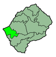
District de Mafeteng
Mafeteng est un district du Lesotho.
Catégorie : District du Lesotho
Wikimedia Foundation.
2010.
Contenu soumis à la licence CC-BY-SA. Source : Article District de mafeteng de Wikipédia en français (auteurs)
Regardez d'autres dictionnaires:
District De Mafeteng — Mafeteng Administration Pays Lesotho Type District Capitale Mafeteng … Wikipédia en Français
District de Mafeteng — 29°50′S 27°55′E / 29.833, 27.917 … Wikipédia en Français
Mafeteng — A view of Likhoele, Mafeteng s second highest mountain, from the reservoir by Kingsgate Primary School … Wikipedia
Mafeteng — Administration Pays Lesotho … Wikipédia en Français
Mafeteng District — Mafeteng District Map of Lesotho with the district highlighted Country … Wikipedia
District De Berea — Berea Administration Pays Lesotho Type District Capitale Teyateyaneng … Wikipédia en Français
District De Butha-Buthe — Butha Buthe Administration Pays Lesotho Type District Capitale … Wikipédia en Français
District De Leribe — Leribe Administration Pays Lesotho Type District Capitale Hlotse … Wikipédia en Français
District De Maseru — Maseru Administration Pays Lesotho Type District Capitale Maser … Wikipédia en Français
District De Mohale's Hoek — Mohale s Hoek Administration Pays Lesotho Type District Capitale … Wikipédia en Français