Chhota Udaipur

Chhota Udaipur
Chhota Udaipur

Ajouter une image
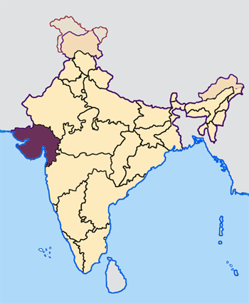
Administration
Pays Drapeau d'Inde Inde
État et territoire Gujarat
District Vadodara
Démographie
Population 22 988 hab. (2001)
Géographie
Coordonnées 22° 15′ 31″ N 71° 11′ 33″ E / 22.2586520, 71.192380522° 15′ 31″ Nord
       71° 11′ 33″ Est
/ 22.2586520, 71.1923805
  

Géolocalisation sur la carte : Inde

Voir la carte administrative
Chhota Udaipur

Géolocalisation sur la carte : Inde

Voir la carte topographique
Chhota Udaipur

Chhota Udaipur (gujarâtî : છોટાઉદેપુર - hindî : छोटा उदयपुर) est une ville et une municipalité de l'État du Gujarat en Inde, dans le district de Vadodara, et un ancien État princier des Indes.


Sommaire

La ville

Géographie

Économie

La principauté

Histoire

La principauté se trouvait à l'est de Baroda.

L'ancêtre de la dynastie est Patai Râwal, le dernier râja de Champaner (fin XVe siècle).

La principauté a intégré l'État du Gujarat le 10 mars 1948.

À propos du drapeau

Les éléments du drapeau font référence à la prise de la forteresse de Pawagadh par Mahmud Shâh en 1482 et à la mort de Patai Râwal. Pawagadh signifie « quart de mont », une partie de la montagne himalayenne porté par le dieu Hanoumân dans le Rāmāyana.

Ex-principauté de
Chotâ Udaipur
Drapeau Chota Udaipur.jpg
Fondateur
Fondée en avant 1750
Dynastie Chauhan
Religion hindoue
Superficie 2 305 km²
Salve 9 coups de canon

Dirigeants : Mahârâwals

  • 1762 - 1771 : Arsisinhji
  • 1771 - 1777 : Hamirsinhji II
  • 1777 - 1822 : Bhimsinhji
  • 1822 - 1851 : Gumansimhji
  • 1851 - 1881 : Jitsimhji
  • 1881 - 1895 : Motisimhji
  • 1895 - 1923 : Fatehsimhji
  • 1923 - 1946 : Natwarsimhji Fatehsimhji
  • 1946 - 1947 : Virendrasimhji

Voir aussi

Articles connexes

Lien externe


Emblem of India.svg États du Gujarat
Gouverneurs | Chief Ministers | Districts
Divisions administratives :
Tehsil
District
IndiaGujarat.png
 • Capitales : Gandhinagar
 • Grandes villes : Ahmedabad | Surat | Vadodara | Rajkot | Jamnagar | Bhavnagar
 • Districts : Ahmedabad | Amreli | Anand | Banaskantha | Bharuch | Bhavnagar | Dahod | Dang | Gandhinagar | Jamnagar | Junagadh | Kheda | Kutch | Mehsana | Narmada | Navsari | Panchmahal | Patan | Porbandar | Rajkot | Sabarkantha | Surat | Surendranagar | Tapi | Vadodara | Valsad

 • Histoire • Personnalité • Ville


Wikimedia Foundation. 2010.

Contenu soumis à la licence CC-BY-SA. Source : Article Chhota Udaipur de Wikipédia en français (auteurs)

Игры ⚽ Поможем написать реферат

Regardez d'autres dictionnaires:

  • Chhota Udaipur —   city   …   Wikipedia

  • Chhota Udaipur (Lok Sabha constituency) — Chhota Udaipur Lok Sabha constituency (Gujarati: છોટા ઉદેપુર લોકસભા મતવિસ્તાર) is one or the 26 Lok Sabha (parliamentary) constituencies in Gujarat state in western India. Contents 1 Assembly segments 2 Members of Parliament 3 See al …   Wikipedia

  • Chhota — is the Hindi word for small or little ,[1] and may refer to: Chhota Chhindwara, a town in Narsinghpur district in the state of Madhya Pradesh, India Chhota Gobindpur, a census town in Purbi Singhbhum district in the state of Jharkhand, India… …   Wikipedia

  • Udaipur (disambiguation) — Udaipur is a common name for locations in India :*Chhattisgarh ** Udaipur, Chhattisgarh *Gujarat ** Chhota Udaipur, a constituency and former princely state *Himachal Pradesh ** Udaipur, Himachal Pradesh (in Lahaul) *Rajasthan ** Udaipur,… …   Wikipedia

  • Udaipur —  Cette page d’homonymie répertorie les différentes localités partageant un même nom. Udaipur est le nom de plusieurs localités du sous continent indien : En Inde : Udaipur, Chhattisgarh Udaipur, Himachal Pradesh Udaipur, Rajasthan… …   Wikipédia en Français

  • Chhota Udepur — Original name in latin Chhota Udepur Name in other language Chhota Udepur, Chota Udaipur State code IN Continent/City Asia/Kolkata longitude 22.30401 latitude 74.0158 altitude 150 Population 24517 Date 2012 11 08 …   Cities with a population over 1000 database

  • List of Indian Princely States — Hundreds of princely states in British India existed prior to the independence of India and Pakistan (including the present Bangladesh) in 1947, ruled by semi independent potentates. Only four of the largest of these states were still directed by …   Wikipedia

  • Rewa Kantha Agency — Die Rewa Kantha Agency waren eine 1821 26 geschaffene administrative Gruppierung von indischen Fürstenstaaten, davon sechs größeren und 55 Zwergstaaten, zur Zeit der britischen Kolonialherrschaft. Im Süden grenzte sie an die Mewas, Teil des… …   Deutsch Wikipedia

  • List of India-related articles — Articles (arranged alphabetically) related to India or Indian culture include: NOTOC List of India related topics People are listed by their first names. 1231 SGM 3 STR 2002 Gujarat violence 2005 in India ( previous years ) 2004 Indian Ocean… …   Wikipedia

  • Index of India-related articles — Articles (arranged alphabetically) related to India or Indian culture include: List of India related topics Contents: Top · 0–9 A B C D E F G H I J K L M N O P Q R S T U V W X Y Z People are listed by their first names …   Wikipedia

Share the article and excerpts

Direct link
Do a right-click on the link above
and select “Copy Link”