Castle Valley
Contenu soumis à la licence CC-BY-SA. Source : Article Castle Valley de Wikipédia en français (auteurs)
Regardez d'autres dictionnaires:
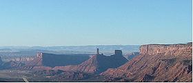
Castle Valley — Der Castle Rock in der Nähe von Castle Valley Lage in Utah … Deutsch Wikipedia
Castle Valley — Castle Valley, UT U.S. town in Utah Population (2000): 349 Housing Units (2000): 230 Land area (2000): 8.082417 sq. miles (20.933364 sq. km) Water area (2000): 0.000000 sq. miles (0.000000 sq. km) Total area (2000): 8.082417 sq. miles (20.933364… … StarDict's U.S. Gazetteer Places
Castle Valley, UT — U.S. town in Utah Population (2000): 349 Housing Units (2000): 230 Land area (2000): 8.082417 sq. miles (20.933364 sq. km) Water area (2000): 0.000000 sq. miles (0.000000 sq. km) Total area (2000): 8.082417 sq. miles (20.933364 sq. km) FIPS code … StarDict's U.S. Gazetteer Places
Castle Valley (Utah) — Saltar a navegación, búsqueda Vista de Valley, Utah Castle Valley es una localidad del condado de Grand, estado de Utah, Estados Unidos. Según el censo de 2000, la población era de 349 habitantes … Wikipedia Español
Castle Valley, Utah — Infobox Settlement official name = Castle Valley, Utah settlement type = Town nickname = motto = imagesize = image caption = image mapsize = 250px map caption = Location of Castle Valley, Utah mapsize1 = map caption1 = subdivision type = Country… … Wikipedia
Castle Dale — Museum von San Rafael Lage in Utah … Deutsch Wikipedia
Ruined Castle Valley — noun a valley in central eastern Qld near the upper Dawson River. {named such because of the similarity of its rock formations to the ruined castles of Germany} …
Castle Dale, Utah — Infobox Settlement official name = Castle Dale, Utah settlement type = City nickname = motto = imagesize = image caption = Castle Dale s city hall image mapsize = 250px map caption = Location of Castle Dale, Utah mapsize1 = map caption1 =… … Wikipedia
Castle Frank Brook — Castle Frank redirects here. For the TTC subway station, see Castle Frank (TTC). Coordinates: 43°40′11″N 79°21′31″W / 43.66972°N 79.35861°W … Wikipedia
Castle Pines Village, Colorado — Castle Pines Village Unincorporated area (U6) … Wikipedia
 États-Unis
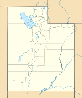
 Utah
Utah