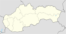
Uňatín
Contenu soumis à la licence CC-BY-SA. Source : Article Uňatín de Wikipédia en français (auteurs)
Regardez d'autres dictionnaires:
Uňatín — is a village and municipality in the Krupina District of the Banská Bystrica Region of Slovakia … Wikipedia
Hnilica — Pavel Mária Hnilica SJ, im deutschsprachigen Raum meist als Paul Hnilica bekannt, (* 30. März 1921 in Unatin, Slowakei; † 8. Oktober 2006) war ein römisch katholischer slowakischer Untergrundbischof. Der Jesuit saß längere Zeit wegen seines… … Deutsch Wikipedia
Pavel Mária Hnilica — SJ, im deutschsprachigen Raum meist als Paul Hnilica bekannt, (* 30. März 1921 in Unatin, Slowakei; † 8. Oktober 2006) war ein römisch katholischer slowakischer Untergrundbischof. Der Jesuit saß längere Zeit wegen seines Glaubens im Gefängnis. Am … Deutsch Wikipedia
Banská Bystrica Region — Geobox | Region name = Banská Bystrica other name = category = Region image caption = image caption = symbol = symbol type = Coat of arms etymology = official name = motto = nickname = country = Slovakia country state = region = district =… … Wikipedia
Dudince — Coordinates: 48°10′00″N 18°52′58″E / 48.1666667°N 18.88278°E / 48.1666667; 18.88278 … Wikipedia
Krupina District — Infobox Slovak district subject name = Krupina District region district slovak region = Banská Bystrica Region population = 22,841 (2001) prefix = ? area = 585 car plate = KA image location = Okres krupina.png Krupina District ( okres Krupina )… … Wikipedia
Cerovo — Krupina in the Banská Bystrica Region Cerovo (earlier Čerové, Čerowo; Hungarian: Ceri) is a village and municipality in the Krupina District of the Banská Bystrica Region of Slovakia. History The village was first … Wikipedia
Devičie — Krupina in the Banská Bystrica Region Devičie (Hungarian: Devicse) is a village and municipality in the Krupina District of the Banská Bystrica Region of Slovakia. History Settlements from the Bronze Age … Wikipedia
Dolné Mladonice — Krupina in the Banská Bystrica Region Dolné Mladonice (Hungarian: Alsólégénd) is a village and municipality in the Krupina District of the Banská Bystrica Region of Slovakia. History In historical record … Wikipedia
Dolný Badín — Krupina in the Banská Bystrica Region Dolný Badín (Hungarian: Alsóbágyon, earlier Alsóbadin) is a village and municipality in the Krupina District of the Banská Bystrica Region of Slovakia. History The area of the village … Wikipedia
 Slovaquie
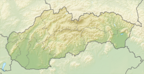
 Uňatín