Rápolt
- Rápolt
-
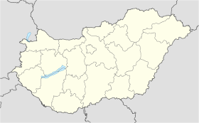
Rápolt est un village et une commune du comitat de Szabolcs-Szatmár-Bereg en Hongrie.
Géographie
Cette section est vide, insuffisamment détaillée ou incomplète.
Votre aide est la bienvenue !
Histoire
Cette section est vide, insuffisamment détaillée ou incomplète.
Votre aide est la bienvenue !
Catégorie :
- Ville et village du comitat de Szabolcs-Szatmár-Bereg
Wikimedia Foundation.
2010.
Contenu soumis à la licence CC-BY-SA. Source : Article Rápolt de Wikipédia en français (auteurs)
Regardez d'autres dictionnaires:
Rápolt — Infobox Settlement settlement type = subdivision type = Country subdivision name = HUN latd= |latm= |lats= |latNS=N longd= |longm= |longs= |longEW=Epushpin pushpin label position = pushpin map caption = pushpin mapsize = timezone=CET utc… … Wikipedia
Haus Palant — Nordseite der verbliebenen Vorburg mit ihrem Torbau Das Haus Palant (auch Schloss Palant) war der Stammsitz der einflussreichen Adelsfamilie von Palant im Eschweiler Stadtteil Weisweiler. Es liegt an dessen nordöstlichem Rand, unmittelbar an der… … Deutsch Wikipedia
Rapoltu Mare — Groß Rapolden Nagyrápolt Hilfe zu Wappen … Deutsch Wikipedia
Nyíregyháza — City center … Wikipedia
Szabolcs-Szatmár-Bereg County — Infobox Hungarian county name =Szabolcs Szatmár Bereg region =Northern Great Plain seat = Nyíregyháza area = 5936 population = 572,423 density = 96 cities = 228Szabolcs Szatmár Bereg is an administrative county (Hungarian: megye ) in north… … Wikipedia
Máriapócs — Country Hungary County Szabolcs Szatmár Bereg Area Total 22.09 km2 (8 … Wikipedia
Nagykálló — Country Hungary County Szabolcs Szatmár Bereg Area – Total 68.55 km2 (26 … Wikipedia
Nyírtass — Country Hungary County Szabolcs Szatmár Bereg Area Total 37.95 km2 (14 … Wikipedia
Baktalórántháza — Market Town Aerial photograph: Baktalórántháza Palace … Wikipedia
Csenger — Country Hungary County Szabolcs Szatmár Bereg Area Total 36.16 km2 (14&# … Wikipedia


 Hongrie
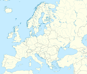

 Rápolt


