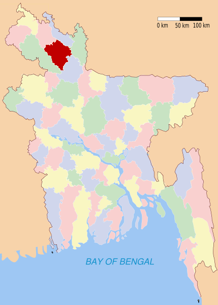
Rangpur (district)
Contenu soumis à la licence CC-BY-SA. Source : Article Rangpur (district) de Wikipédia en français (auteurs)
Regardez d'autres dictionnaires:
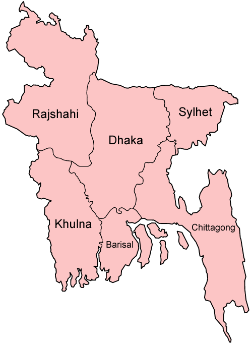
Rangpur District — Infobox of BD districts native name = Rangpur skyline = Tajhat Rajbari side.jpg skyline size = skyline caption = Tajhat Rajbari is now Rangpur Museum locator position = right latd = 25.60 longd = 89.25 division name = Rajshahi Division population … Wikipedia
Rangpur District — Admin ASC 2 Code Orig. name Rangpur District Country and Admin Code BD.87.55 BD … World countries Adminstrative division ASC I-II
Rangpur District — noun One of the eight districts in the Rangpur Division of Bangladesh … Wiktionary
Rangpur, Bangladesh — Rangpur ( bn. রংপুর) is one of the major cities in Bangladesh. Rangpur is considered as the centre of northwestern Bangladesh. Recently established public university of Bangladesh named as The University of Rangpur is situated in the southern… … Wikipedia
Rangpur Zilla School — Rangpur Zila School (Rangpur District School) is a school located in Rangpur District, Bangladesh. It is one of the earliest schools established in Bengal. The school was established in 1832 as Rangpur Zamindar School, by the local Zaminders or… … Wikipedia
Rangpur — stands for the following: *Rangpur (fruit) citrus fruit;places *Rangpur Baghoor *Rangpur, India *Rangpur District in Bangladesh **Rangpur, Bangladesh, administrative centre of Rangpur District *Rangpur, Punjab, town in Punjab. *Rangpur (Ahom… … Wikipedia
Rangpur (ville du Bangladesh) — Rangpur Vue de la ville de Rangpur Administration Pays … Wikipédia en Français
Rangpur Sadar Upazila — Infobox of upazilas native name = Rangpur Sadar locator position = right latd = 25.7583 longd = 89.2333 division name = Rajshahi Division district = Rangpur District population as of = 1991 population total = 494317 population density = 1496 area … Wikipedia
Rangpur Medical College — is one of the major government medical college in Bangladesh located in Rangpur. =Brief History=To meet up the growing needs of modern medicine The Government of East Pakistan established a medical college in Rangpur in 1970 with a 500 beded… … Wikipedia
Rangpur Cadet College — Rangpur Cadet College, is a military high school in Bangladesh.HistoryRangpur Cadet College was established with a view to provide opportunities for the young generation of the nation to develop themselves as the eligible and worthy citizen of… … Wikipedia