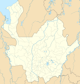
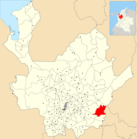
Puerto Nare
- Puerto Nare
-
Catégories :
- Ville de Colombie
- Municipalité d'Antioquia
Wikimedia Foundation.
2010.
Contenu soumis à la licence CC-BY-SA. Source : Article Puerto Nare de Wikipédia en français (auteurs)
Regardez d'autres dictionnaires:
Puerto Nare — Saltar a navegación, búsqueda Puerto Nare Bandera … Wikipedia Español
Puerto Nare — is a town and municipality in the Colombian department of Antioquia … Wikipedia
Iglesia de San Luis Beltrán (Puerto Nare) — Iglesia de San Luis Beltrán Tipo Iglesia Ubicación Puerto Nare, Antioquia Colombia … Wikipedia Español
Puerto Berrío — Saltar a navegación, búsqueda Puerto Berrío Bandera … Wikipedia Español
Puerto Triunfo — Saltar a navegación, búsqueda Puerto Triunfo Bandera … Wikipedia Español
Puerto Berrío — is a municipality and town in the Colombian department of Antioquia. Puerto Berrío is located in a region of Antioquia known as the Middle Magdalena (near the Magdalena River). It limits by the north with the municipalities of Yolombó, Remedios… … Wikipedia
Puerto Boyacá — is a Colombian river port town and municipality by the Magdalena River in the Boyacá Department, where is also considered a Special Handling Zone due to its port status. Its main industries are oil exploration and processing. In the 1980s and… … Wikipedia
Puerto Berrío — 6° 29′ 24″ N 74° 24′ 09″ W / 6.49, 74.4025 … Wikipédia en Français
Puerto Triunfo — 5° 52′ 00″ N 74° 39′ 00″ W / 5.866667, 74.65 … Wikipédia en Français
Puerto Boyacá — Saltar a navegación, búsqueda 5°58′41″N 74°35′23″O / 5.97806, 74.58972 … Wikipedia Español


 Colombie
 Antioquia