Poulton-le-Fylde
- Poulton-le-Fylde
-
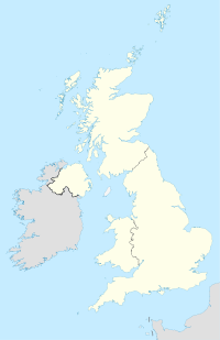
Poulton-le-Fylde est une ville du nord-ouest de l'Angleterre, située à dix kilomètres de Blackpool. Sa population est de 18 264 habitants[1].
Références
Wikimedia Foundation.
2010.
Contenu soumis à la licence CC-BY-SA. Source : Article Poulton-le-Fylde de Wikipédia en français (auteurs)
Regardez d'autres dictionnaires:
Poulton-le-Fylde — (spr. pōlt n lĭ sĭld), Stadt in Lancashire (England), nahe der Mündung des Wyre, 8 km südöstlich von Fleetwood, hat eine alte Kirche im normannischen Stil und (1901) 2223 Einw … Meyers Großes Konversations-Lexikon
Poulton-le-Fylde — infobox UK place country = England latitude= 53.847 longitude= 2.995 official name= Poulton le Fylde population = 19,480 (2001 Census) shire district= Wyre shire county = Lancashire region= North West England constituency westminster= Lancaster… … Wikipedia
Poulton le Fylde — Original name in latin Poulton le Fylde Name in other language Poulton, Poulton le Fylde State code GB Continent/City Europe/London longitude 53.83333 latitude 2.98333 altitude 14 Population 19914 Date 2012 01 17 … Cities with a population over 1000 database
Poulton-le-Fylde railway station — Infobox UK station name = Poulton le Fylde manager = Northern Rail locale = Poulton le Fylde borough = Wyre start = platforms = 2 usage0405 = 0.301 usage0506 = 0.321 usage0607 = 0.339 latitude = 53.8484 longitude = 2.9906 gridref = years = 15… … Wikipedia
Church of St John the Evangelist, Poulton-le-Fylde — St John s Church Church of St John the Evangelist St John s Church from Breck Road, to the west … Wikipedia
Poulton — may refer to:;Places *Poulton, Cheshire **RAF Poulton, Cheshire *Poulton, Merseyside, England *Poulton, Gloucestershire, England *Poulton Lancelyn, Merseyside, England *Poulton le Fylde, Lancashire, England *Poulton le Sands, the village that… … Wikipedia
Poulton-le-Sands — was one of three small villages that combined to create Morecambe. Poulton was first mentioned in the Domesday Book as Poltune . It later became Poulton and remained this way for a number of centuries. It was towards the end of the eighteenth or… … Wikipedia
Fylde North (UK Parliament constituency) — Coordinates: 53°55′05″N 2°56′20″W / 53.918°N 2.939°W / 53.918; 2.939 … Wikipedia
Poulton Curve Halt railway station — Infobox UK disused station name = Poulton Curve manager = LYR / LNWR locale = Poulton le Fylde borough = Wyre platforms = 2 caption = line = Lancashire and Yorkshire Railway / London and North Western Railway latitude = 53.8499 | longitude =… … Wikipedia
Fylde — Borough of Fylde Lage in Lancashire Status Borough Region North West England Verw.grafschaft Lancashire … Deutsch Wikipedia
 Angleterre
