Nebočaj

Nebočaj

43° 56′ 13″ N 18° 18′ 23″ E / 43.9369, 18.3064

Nebočaj
Небочај
Administration
Pays Drapeau de Bosnie-Herzégovine Bosnie-Herzégovine
Entité Drapeau de la Fédération de Bosnie-et-Herzégovine Fédération de Bosnie-et-Herzégovine
Canton Sarajevo
Municipalité Vogošća
Géographie
Coordonnées 43° 56′ 13″ Nord
       18° 18′ 23″ Est
/ 43.9369, 18.3064
Démographie
Population 465 hab. (1991)
Localisation
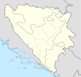
Bosnia and Herzegovina location map.svg
City locator 15.svg
Nebočaj

Nebočaj (en serbe cyrillique : Небочај) est un village de Bosnie-Herzégovine. Il est situé dans la municipalité de Vogošća et dans le canton de Sarajevo, Fédération de Bosnie-et-Herzégovine. Au recensement de 1991, il comptait 465 habitants, dont une majorité de Serbes[1].

Sommaire

Démographie

Répartition de la population (1991)

Nationalité Nombre %
Serbes 356 76,56
Musulmans 94 20,21
Yougoslaves 13 2,80
Inconnus/autres 2 0,43[1]

Notes et références

  1. a et b (bs)(hr)(sr) Livre : Composition nationale de la population - Résultats de la République par municipalités et localités 1991, Bulletin statistique n°234, Publication de l'Institut national de statistique de Bosnie-Herzégovine, Sarajevo.

Voir aussi

Articles connexes

Liens externes


Wikimedia Foundation. 2010.

Contenu soumis à la licence CC-BY-SA. Source : Article Nebočaj de Wikipédia en français (auteurs)

Игры ⚽ Поможем написать реферат

Regardez d'autres dictionnaires:

  • Nebočaj — is village in Vogošća municipality, near Sarajevo, Federation of Bosnia and Herzegovina, Bosnia and Herzegovina. Contents 1 Population 1.1 Ethnic composition, 1991 census 2 History …   Wikipedia

  • Vogošća — 43° 54′ 07″ N 18° 20′ 53″ E / 43.9019, 18.3481 …   Wikipédia en Français

  • List of settlements in Bosnia and Herzegovina — This is a complete list of settlements in Bosnia and Herzegovina, as recorded by 1991 census, sorted by municipalities. Town of Sarajevo = Sarajevo Centar = • Mrkovići • Nahorevo• Poljine• Radava• Sarajevo (part of settlement)• Vića Sarajevo… …   Wikipedia

  • Vogosca — Vogošća Вогошћа Hilfe zu Wappen …   Deutsch Wikipedia

  • Vogošća — Вогошћа …   Deutsch Wikipedia

  • Vogosca — Vogošća Vogošća Вогошћа [[Image:|100px|center|Blason]] [[Image:|100px|center|Drapeau]] Blason Drapeau …   Wikipédia en Français

  • Vogošća — Organización territorial de la Federación de Bosnia y Herzegovina de Bosnia y Herzegovina …   Wikipedia Español

  • Blagovac — 43° 54′ 45″ N 18° 21′ 33″ E / 43.9125, 18.3592 …   Wikipédia en Français

  • Budišići — 43° 55′ 52″ N 18° 23′ 29″ E / 43.9311, 18.3914 …   Wikipédia en Français

  • Donja Vogošća — 43° 55′ 43″ N 18° 18′ 22″ E / 43.9286, 18.3061 …   Wikipédia en Français

Share the article and excerpts

Direct link
Do a right-click on the link above
and select “Copy Link”