Mthatha

Mthatha
Mthatha
Administration
Pays Drapeau d'Afrique du Sud Afrique du Sud
Province Cap-Oriental
Géographie
Coordonnées 31° 34′ 00″ Sud
       28° 46′ 00″ Est
/ -31.566667, 28.766667
Altitude 698 m
Démographie
Population 120 000 hab. (2008, est.)
Localisation
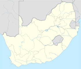
South Africa location map.svg
City locator 14.svg
Mthatha

Mthatha (anciennement Umtata) est une ville d'Afrique du Sud, située dans la province du Cap-Oriental.

Sommaire

Histoire

Umtata et les montagnes du Drakensberg en 1913 - peinture de Caesar Carl Hans Henkel (1839-1913)

Umtata fut un relais militaire pour les forces impériales britanniques à partir de 1882 avant de devenir une ville en 1883. Elle est située sur les rives du fleuve Mthatha. Des cathédrales anglicanes et catholiques y furent élevées et elle devint le centre administratif de toute la région.

Dans le cadre de l'apartheid et de la politique de développement séparé, elle devint la capitale du Transkei, un bantoustan constitué à la fin du XIXe siècle par les territoires indigènes d'Idutywa, de Fingoland, de Galekaland, du Griqualand-Est, du Bomvanaland, du Thembuland et du Pondoland. Déclaré autonome en 1963 puis indépendant en 1976, le Transkei, constitué pour les peuples xhosas, ne fut jamais reconnu au niveau international et a réintégré l'Afrique du Sud en 1994.

Musées

Mthatha abrite trois musées consacré à Nelson Mandela, né dans le village de Mvezo situé à quelques kilomètres plus au sud.

L'astronome sud-africain Cyril V. Jackson donna son nom à un astéroïde qu'il repéra en 1936.

Administration

Mthatha est la ville principale au sein de la municipalité locale de King Sabata Dalindyebo.

Personnalités liées à la ville

Lien externe


Wikimedia Foundation. 2010.

Contenu soumis à la licence CC-BY-SA. Source : Article Mthatha de Wikipédia en français (auteurs)

Игры ⚽ Нужно сделать НИР?

Regardez d'autres dictionnaires:

  • Mthatha — Umtata   Town   Panoramic view of Mthatha and the Drakensberg mountains (1913) by Caesar Carl Hans Henkel …   Wikipedia

  • Mthatha — Mthatha …   Deutsch Wikipedia

  • Anglican Diocese of Mthatha — The Anglican Diocese of Mthatha [ [http://www.anglicancommunion.org/tour/diocese.cfm?Idind=526 Contact details] ] is the new name for a diocese which contains much (but not all) of the old St John’s area. It came into existence in 2006 [ [… …   Wikipedia

  • Anglican Church of Southern Africa — Primate Thabo Makgoba Territory Angola, Lesotho, Mozambique, Namibia, Saint Helena, South Africa and Swaziland Members approximately 3 4 million[1] …   Wikipedia

  • Oswald Hirmer — Oswald Georg Hirmer (* 28. Februar 1930 in Amberg; † 5. März 2011 in Durban) war ein deutscher Geistlicher, Missionar und römisch katholischer Bischof von Umtata. Inhaltsverzeichnis 1 Leben 2 Schriften …   Deutsch Wikipedia

  • OR Tambo International Airport — Johannesburg International Airport IATA: JNB – ICAO: FAJS – WMO: 68368 …   Wikipedia

  • Transkei — Infobox Former Country native name = conventional long name = Republic of Transkei common name = Transkei continent = Africa region = Southern Africa country = South Africa status = Bantustan empire = event start = Self government year start =… …   Wikipedia

  • N2 road (South Africa) — National Route N2 Route information …   Wikipedia

  • Bishop of St John's — The Bishop of St John’s is the Bishop of the Diocese of St Johns in the Anglican Church of Southern Africa, which encompassed the area around King Williams Town and East London and is located in the Eastern Cape Province of South Africa. In 1991… …   Wikipedia

  • Anglican Church of Southern Africa — Ehemaliger Primas und Friedensnobelpreisträger Desmond Tutu Die Anglican Church of Southern Africa (deutsch Anglikanische Kirche des südlichen Afrikas), bis 2006 Church of the Province of Southern Africa, ist ein Teil der anglikanischen… …   Deutsch Wikipedia

Share the article and excerpts

Direct link
Do a right-click on the link above
and select “Copy Link”