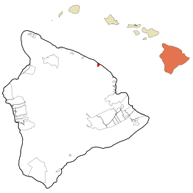
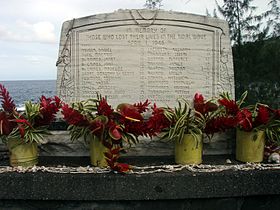
Laupāhoehoe
Contenu soumis à la licence CC-BY-SA. Source : Article Laupāhoehoe de Wikipédia en français (auteurs)
Regardez d'autres dictionnaires:
Laupahoehoe — Lugar designado por el censo de los Estados Unidos … Wikipedia Español
Laupahoehoe — Laupahoehoe, HI U.S. Census Designated Place in Hawaii Population (2000): 473 Housing Units (2000): 196 Land area (2000): 2.075780 sq. miles (5.376246 sq. km) Water area (2000): 0.188949 sq. miles (0.489376 sq. km) Total area (2000): 2.264729 sq … StarDict's U.S. Gazetteer Places
Laupahoehoe, HI — U.S. Census Designated Place in Hawaii Population (2000): 473 Housing Units (2000): 196 Land area (2000): 2.075780 sq. miles (5.376246 sq. km) Water area (2000): 0.188949 sq. miles (0.489376 sq. km) Total area (2000): 2.264729 sq. miles (5.865622 … StarDict's U.S. Gazetteer Places
Laupahoehoe High and Elementary School — is a public schools in Laupahoehoe, Hawaii. It was established in 1904 and serves kindergarten through the twelfth grade. The school boasts the 1939 wood sculpture Spear Fisherman by Isamu Noguchi and the 1975 outdoor wood sculpture Heritage… … Wikipedia
Laupāhoehoe, Hawai'i — Infobox Settlement official name = Laupahoehoe, Hawaii other name = native name = nickname = settlement type = CDP motto = imagesize = image caption = flag size = image seal size = image shield = shield size = image blank emblem = blank emblem… … Wikipedia
Réserve naturelle d'État Laupāhoehoe — Catégorie UICN V (paysage terrestre/marin protégé) Identifiant 999983 Pays … Wikipédia en Français
Saint Anthony Catholic Church in Laupahoehoe — is a parish of the Roman Catholic Church of Hawaii in the United States. Located in Laupahoehoe on the Big Island of Hawaii, the church falls under the jurisdiction of the Diocese of Honolulu and its bishop. It is named after Saint Anthony of… … Wikipedia
96764 — Laupahoehoe, Hi (Miscellaneous » ZIP Codes) … Abbreviations dictionary
Hawaii Belt Road — The Hawaiʻi Belt Road is a modern name for the Māmalahoa Highway and consists of Hawaiʻi state Routes 11, 19, and 190 that encircle the Island of Hawaiʻi. The southern section, between Hilo and Kailua Kona is numbered as Route 11. The section… … Wikipedia
Mauna Kea — Pour les articles homonymes, voir Mauna. Mauna Kea Vue du Mauna Kea depuis l observatoire du Mauna Loa … Wikipédia en Français
 États-Unis
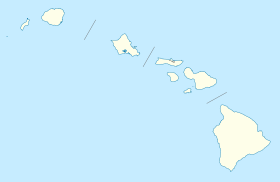
 Hawaï
Hawaï