- Kysucký Lieskovec
-
Kysucký Lieskovec
(Village)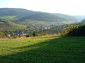
Administration Pays  Slovaquie
Région Région de Žilina District District de Kysucké Nové Mesto Code postal 023 34 Plaque minéralogique KM Starosta (maire) Štefan Mrenka ( Indépendant )
Mandat: 2013
Démographie Population 2 305 hab. (31.12.2007) Densité 187,1 hab./km2 Géographie Coordonnées Altitude 368 m Superficie 1 232,0111 ha = 12,320111 km² Localisation en Slovaquie 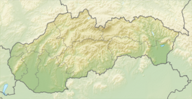
 Kysucký Lieskovec
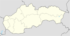 Kysucký Lieskovec
Localisation dans la région de Žilina Sources Resultat des élections http://www.e-obce.sk [1] http://www.statistics.sk [2] http://www.slovakregion.sk/ [3]
Kysucký Lieskovec (hongrois : Újhelymogyoród)[4] est un village de Slovaquie situé dans la région de Žilina.Histoire
La première mention écrite du village date de 1438[2].
Notes et références
- (sk) e-obce.sk. Consulté le 13 février 2010
- (sk) (en) Mestská a obecná štatistika SR. Consulté le 13 février 2010
- (sk) Slovak region. Consulté le 13 février 2010
- (sk) Slovenské slovníky. Consulté le 13 février 2010
Catégories :- Village de Slovaquie
- Village et ville du district de Kysucké Nové Mesto


Wikimedia Foundation. 2010.