Kranji Do
- Kranji Do
-
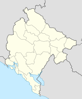
Kranji Do (en serbe cyrillique: Крањи До) est un village du sud du Monténégro, dans la municipalité de Cetinje.
Démographie
Évolution historique de la population[1]
Évolution démographique
| 1948 |
1953 |
1961 |
1971 |
1981 |
1991 |
2003 |
| 85 |
94 |
79 |
88 |
54 |
34 |
30 |
Pyramide des âges (2003)
| Pyramide des âges de la ville de Kranji Do |
Pyramide des âges de la ville de Kranji Do en 2003 (population totale : 30)[2] :
| Hommes |
Classe d'âge |
Femmes |
|
0
|
? |
0
|
|
0
|
80 et plus |
2
|
|
0
|
75-79 |
2
|
|
1
|
70-74 |
1
|
|
2
|
65-69 |
2
|
|
0
|
60-64 |
1
|
|
2
|
55-59 |
0
|
|
1
|
50-54 |
2
|
|
2
|
45-49 |
1
|
|
1
|
40-44 |
1
|
|
0
|
35-39 |
1
|
|
2
|
30-34 |
0
|
|
0
|
25-29 |
0
|
|
1
|
20-24 |
0
|
|
1
|
15-19 |
1
|
|
2
|
10-14 |
1
|
|
0
|
5-9 |
0
|
|
0
|
0-4 |
0
|
|
Répartition de la population par nationalités (2003)
Source[3]
| Répartition de la population par nationalités |
Nombre |
% |
| Monténégrins |
30 |
100 |
| Inconnus/Autres |
0 |
0 |
Notes et références
- ↑ (sr) Књига 9, Становништво, упоредни преглед броја становника 1948, 1953, 1961, 1971, 1981, 1991, 2003, подаци по насељима, Републички завод за статистику, Подгорица, септембар 2005, COBISS-ID 8764176
- ↑ (sr) Књига 2, Становништво, пол и старост, подаци по насељима, Републички завод за статистику, Подгорица, октобар 2004, COBISS.CG-ID 8489488
- ↑ (sr) Књига 1, Становништво, национална или етничка припадност, подаци по насељима, Републички завод за статистику, Подгорица, септембар 2004, ISBN 86-84433-00-9
Catégories :
- Village du Monténégro
- Localité de Cetinje
Wikimedia Foundation.
2010.
Contenu soumis à la licence CC-BY-SA. Source : Article Kranji Do de Wikipédia en français (auteurs)
Regardez d'autres dictionnaires:
Kranji — SG neighbourhood image englishname=Kranji chinesename=克兰芝 poj= pengim= pinyin=Kèlánzhī malayname=Kranji tamilname=கிராஞ்சிKranji is a suburb in northwestern Singapore, located about 22 kilometres (15 miles) from the city centre. Etymology Kranji… … Wikipedia
Kranji — Original name in latin Kranji Name in other language Kranji State code ID Continent/City Asia/Jakarta longitude 6.8775 latitude 112.383 altitude 6 Population 0 Date 2012 06 07 … Cities with a population over 1000 database
Kranji War Cemetery — Infobox Military Cemetery name= Kranji War Cemetery body= Commonwealth War Graves Commission use dates= 1942 1945 established= 1946 designer= Colin St Clair Oakes coordinates= coord|1|25|05|N|103|45|29|E| nearest town= Kranji, Singapore total=… … Wikipedia
Kranji War Memorial — nearest town=Kranji, Singapore designer= inscription=On the walls of this memorial are recorded the names of twenty four thousand soldiers and airmen of many races united in service to the British crown who gave their lives in Malaya and… … Wikipedia
Kranji MRT Station — Infobox Station name=Kranji MRT Station 克兰芝地铁站 கிராஞ்சி type=Rapid transit image size=300 image caption=Platform View of Kranji MRT Station address=960 Woodlands Road Singapore 738702 coordinates= coord|1.253017|103.454267 line=North South… … Wikipedia
Kranji Reservoir — Infobox lake lake name = Kranji Reservoir image lake = caption lake = image bathymetry = caption bathymetry = location = Northern Singapore coords = coord|1|25|42|N|103|44|35|E|region:SG type:waterbody|display=inline,title type = reservoir inflow … Wikipedia
Kranji Secondary School — Infobox Singapore School name = KRANJI SECONDARY SCHOOL Philosophy = We believe in... *teaching with passion and conviction. *every child being able to learn. *the total development of each child. *preparing pupils for future challenges. motto =… … Wikipedia
Kranji Expressway — Vorlage:Infobox hochrangige Straße/Wartung/SG E Kranji Expressway in Singapur Karte … Deutsch Wikipedia
Kranji Expressway — Infobox Singapore Expressway routebox length km = km to mi|num=8|abbr=no|spell=Commonwealth|precision=2|wiki=yes direction = Southwest East start/end1 = Jurong (PIE) start/end2 = Bukit Panjang (BKE) area = Jurong Choa Chu Kang Bukit Panjang… … Wikipedia
Battle of Kranji — Infobox Military Conflict conflict= Battle of Kranji caption= The Japanese invasion of Kranji in February 1942. The arrows indicate attacks by Japanese forces. partof= the Battle of Singapore, Pacific War date= February 9–10, 1942 place= Kranji,… … Wikipedia
 Monténégro