Kalaiya
- Kalaiya
-
Kalaiya est une ville du Népal située dans la zone de Narayani et chef-lieu du district de Bara. Au recensement de 2001, la ville comptait 32 260 habitants[1].
Notes et références
Wikimedia Foundation.
2010.
Contenu soumis à la licence CC-BY-SA. Source : Article Kalaiya de Wikipédia en français (auteurs)
Regardez d'autres dictionnaires:
Kalaiya — Infobox Settlement name = Kalaiya other name = native name = nickname = settlement type =Municipality imagesize = image caption = flag size = image seal size = image shield = shield size = image blank emblem = blank emblem type = blank emblem… … Wikipedia
Binod Das — Infobox cricketer biography playername = Binod Das country = Nepal fullname = Binod Kumar Das nickname = living = true dayofbirth = 26 monthofbirth = 4 yearofbirth = 1983 placeofbirth = Kalaiya, Bara District countryofbirth = Nepal dayofdeath =… … Wikipedia
Madhesi Jana Adhikar Forum, Nepal — Infobox Nepalese Political Party party name = Madhesi Jana Adhikar Forum, Nepal devanagari name = मधेसी जन अधिकार फोरम, नेपाल colorcode = party president = Upendra Yadav foundation = 2006 headquarters = ideology = international = students = youth … Wikipedia
Sanjam Regmi — Infobox cricketer biography playername = Sanjam Regmi country = Nepal fullname = nickname = living = true dayofbirth = 22 monthofbirth = 12 yearofbirth = 1982 placeofbirth = Kalaiya, Bara District countryofbirth = Nepal dayofdeath = monthofdeath … Wikipedia
List of cities in Nepal — This is a list of cities in Nepal.Note: Not all of these localities listed are municipalities. municipalities, of which Nepal momentarily has 58, are marked with a (*). The listed names are the official names of the municipalities, nevertheless… … Wikipedia
East Champaran — is an administrative district in the state of Bihar in India. The district headquarters are located at Motihari. The district occupies an area of 3969 km² and has a population of 3,933,636 (as of 2001). East Champaran is a part of Tirhut Division … Wikipedia
Districts of Nepal — Nepal This article is part of the series: Politics and government of Nepal Government … Wikipedia
Bara District — Infobox Nepal district district = Bara District area = population = pop year = density = caption = region = established = languages = website = Bara District, a part of Narayani Zone, is one of the seventy five districts of Nepal, a landlocked… … Wikipedia
1979 Nepalese student protests — The 1979 student protests in Nepal (Nepali: 2036 Saal ko Aandolan (२०३६ सालको आन्दोलन) [http://www.asianstudies.emory.edu/sinhas/kprb0405a.html Students and Politicians in 36 Saal ko Aandolan ] 9 May 1999] ) were a series of protests amongst the… … Wikipedia
Chhata Pipra — Village Development Committee Country Nepal Zone Narayani Zone … Wikipedia
 Népal
Népal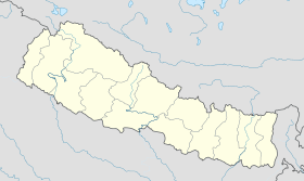
 Kalaiya