Janjac

Janjac

44° 12′ 39″ N 17° 50′ 23″ E / 44.2108, 17.8397

Janjac
Administration
Pays Drapeau de Bosnie-Herzégovine Bosnie-Herzégovine
Entité Drapeau de la Fédération de Bosnie-et-Herzégovine Fédération de Bosnie-et-Herzégovine
Canton Zenica-Doboj
Municipalité Zenica
Géographie
Coordonnées 44° 12′ 39″ Nord
       17° 50′ 23″ Est
/ 44.2108, 17.8397
Démographie
Population 550 hab. (1991)
Localisation
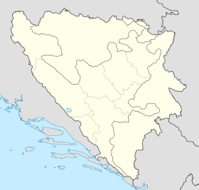
Bosnia and Herzegovina location map.svg
City locator 15.svg
Janjac

Janjac (en cyrillique : Јањац) est un village de Bosnie-Herzégovine. Il est situé dans la municipalité de Zenica et dans le canton de Zenica-Doboj, Fédération de Bosnie-et-Herzégovine. Au recensement de 1991, il comptait 550 habitants, dont une majorité de Croates[1].

Sommaire

Démographie

Répartition de la population (1991)

Nationalité Nombre %
Croates 512 93,10
Serbes 29 5,27
Yougoslaves 4 0,73
Inconnus/autres 5 0,90[1]

En 1991, la communauté locale de Janjac comptait 730 habitants, répartis de la manière suivante[2] :

Nationalité Nombre %
Croates 534 73,15
Serbes 178 24,39
Yougoslaves 8 1,10
Inconnus/autres 10 1,36

Notes et références

  1. a et b (bs)(hr)(sr) Livre : Composition nationale de la population - Résultats de la République par municipalités et localités 1991, Bulletin statistique n°234, Publication de l'Institut national de statistique de Bosnie-Herzégovine, Sarajevo.
  2. (bs)(hr)(sr)[PDF] Recensement par communautés locales sur http://www.fzs.ba, Bosnie-Herzégovine - Fédération de Bosnie-et-Herzégovine - Institut fédéral de statistique. Consulté le 11 octobre 2010

Voir aussi

Articles connexes

Liens externes


Wikimedia Foundation. 2010.

Contenu soumis à la licence CC-BY-SA. Source : Article Janjac de Wikipédia en français (auteurs)

Игры ⚽ Поможем написать курсовую

Regardez d'autres dictionnaires:

  • jánjac — m 〈G jánjca, N mn jȃnjci, G jȃnjācā〉 razg., {{c=1}}v. {{ref}}jaganjac{{/ref}} …   Veliki rječnik hrvatskoga jezika

  • janjac — jánjac m <G jánjca, N mn jȃnjci, G jȃnjācā> DEFINICIJA razg., v. jaganjac ETIMOLOGIJA vidi janje …   Hrvatski jezični portal

  • Janjač — 42° 48′ 45″ N 18° 13′ 11″ E / 42.8125, 18.2197 …   Wikipédia en Français

  • Apartments Janjac — (Водице,Хорватия) Категория отеля: 3 звездочный отель Адрес: Pamuković kamila 96 …   Каталог отелей

  • La Barre-de-Semilly — 49° 06′ 43″ N 1° 01′ 59″ W / 49.1119444444, 1.03305555556 …   Wikipédia en Français

  • List of settlements in Bosnia and Herzegovina — This is a complete list of settlements in Bosnia and Herzegovina, as recorded by 1991 census, sorted by municipalities. Town of Sarajevo = Sarajevo Centar = • Mrkovići • Nahorevo• Poljine• Radava• Sarajevo (part of settlement)• Vića Sarajevo… …   Wikipedia

  • Trebinje — Pour les articles homonymes, voir Trebinje (homonymie). 42° 42′ 43″ N 18° 20′ 39″ E …   Wikipédia en Français

  • Zenica — Pour les articles homonymes, voir Zenica (homonymie). 44° 12′ 05″ N 17° 54′ 23″ E …   Wikipédia en Français

  • Trebinje — Infobox Settlement settlement type = subdivision type = Country subdivision name =Bosnia and Herzegovinasubdivision type1 = Entity subdivision name1 = Republika Srpska subdivision type2 = subdivision name2 = timezone=CET utc offset=+1 timezone… …   Wikipedia

  • Ljubomir (Trebinje) — Pour les articles homonymes, voir Ljubomir. 42° 49′ 08″ N 18° 18′ 00″ E …   Wikipédia en Français

Share the article and excerpts

Direct link
Do a right-click on the link above
and select “Copy Link”