District de Karauli
- District de Karauli
-
Le district de Karauli est un district de l'état du Rajasthan en Inde.
Wikimedia Foundation.
2010.
Contenu soumis à la licence CC-BY-SA. Source : Article District de Karauli de Wikipédia en français (auteurs)
Regardez d'autres dictionnaires:
Karauli district — is a district of Rajasthan state in western India. The town of Karauli is the district headquarters. The district of Karauli encompasses an area of 5530 km². It is bordered by Dholpur District to the east; by Bharatpur District to the north east; … Wikipedia
Karauli — Ajouter une image Administration Pays Inde État et territoire Rajasthan District … Wikipédia en Français
Karauli — Infobox Indian Jurisdiction native name = Karauli | type = city | latd = 26.5 | longd = 77.02 locator position = right | state name = Rajasthan district = Karauli leader title = leader name = altitude = 275 population as of = 2001 population… … Wikipedia
Dausa district — This article is about the district. For its eponymous headquarters, see Dausa. 28. Dausa district in Rajasthan Dausa District is a district of Rajasthan state in western India. The city of Dausa is the district headquarters. Dausa District has a… … Wikipedia
Dholpur district — This article is about the district. For its eponymous headquarters, see Dholpur. Dholpur District is a district of Rajasthan state in western India. The town of Dholpur is the district headquarters. Dholpur District has an area of 3084 km².… … Wikipedia
Nagaur district — This article is about the district. For its eponymous headquarters, see Nagaur. 16. Location in Rajasthan Nagaur District is one of the 33 districts of the state of Rajasthan in western India. Area of the district is 17,718 km2. The city of… … Wikipedia
Churu district — This article is about the district. For its eponymous headquarters, see Churu. Churu District in Rajasthan Churu is a district of Rajasthan state of western India. The town of Churu is the administrative headquarters of the district. Churu lies… … Wikipedia
Chittorgarh district — This article is about the district. For its eponymous headquarters, see Chittorgarh. Not to be confused with Chittoor district. Chittorgarh District is a district of Rajasthan state in western India. The historic city of Chittorgarh is the… … Wikipedia
Dungarpur district — is a district of the state of Rajasthan in western India. The town of Dungarpur is the district headquarters. Contents 1 History 2 Geography 3 Economy 4 … Wikipedia
Bharatpur district — is a district of Rajasthan state in western India. The town of Bharatpur is the district headquarters. The district has an area of 5,066 km². It is bounded by Rewari and Gurgaon districts of Haryana on the north, Mathura and Agra districts of… … Wikipedia
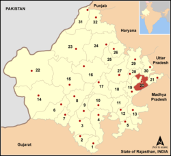 En rouge sur la carte
 Inde
Inde