District de Barmer
- District de Barmer
-
Le District de Barmer est un district de l'état du Rajasthan en Inde.
Wikimedia Foundation.
2010.
Contenu soumis à la licence CC-BY-SA. Source : Article District de Barmer de Wikipédia en français (auteurs)
Regardez d'autres dictionnaires:
Barmer district — Barmer (बाडमेर) is a district of Rajasthan state, India. Barmer is the district headquarters.Balotra, Guda Malani, Baytu, Siwana , Jasol and Chohatan are other major towns. Barmer district is part of the Great Indian Desert or Thar Desert. Like… … Wikipedia
Barmer — may refer to the following places:*Barmer district, a district of Rajasthan state, India **Barmer (Lok Sabha constituency), a Lok Sabha parliamentary constituency of Rajasthan **Barmer, Rajasthan, a city in Barmer district *Bagthorpe with Barmer … Wikipedia
Barmer, Rajasthan — Infobox Indian Jurisdiction native name = Barmer | type = city | latd = 25.75 | longd = 71.38 locator position = right | state name = Rajasthan district = Barmer leader title = leader name = altitude = 227 population as of = 2001 population total … Wikipedia
Barmer (Distrikt) — Distrikt Barmer Bundesstaat: Rajasthan Verwaltungssitz: Barmer Fläche … Deutsch Wikipedia
Barmer — ▪ India town, western Rajasthan (Rājasthān) state, extreme western India. Standing on a rocky hill crowned by a fort, the town is said to have been founded in the 13th century, when it was named Bahadamer (“The Hill Fort of Bahada”) for a… … Universalium
Pali district — (पाली जिला) is a district of the state of Rajasthan in western India. The town of Pali is the district headquarters.The Aravalli Range forms the eastern boundary of the district. A zone of foothills lies to the west, through which run the many… … Wikipedia
Nagaur district — This article is about the district. For its eponymous headquarters, see Nagaur. 16. Location in Rajasthan Nagaur District is one of the 33 districts of the state of Rajasthan in western India. Area of the district is 17,718 km2. The city of… … Wikipedia
Churu district — This article is about the district. For its eponymous headquarters, see Churu. Churu District in Rajasthan Churu is a district of Rajasthan state of western India. The town of Churu is the administrative headquarters of the district. Churu lies… … Wikipedia
Chittorgarh district — This article is about the district. For its eponymous headquarters, see Chittorgarh. Not to be confused with Chittoor district. Chittorgarh District is a district of Rajasthan state in western India. The historic city of Chittorgarh is the… … Wikipedia
Dausa district — This article is about the district. For its eponymous headquarters, see Dausa. 28. Dausa district in Rajasthan Dausa District is a district of Rajasthan state in western India. The city of Dausa is the district headquarters. Dausa District has a… … Wikipedia
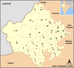 Le numéro 14 sur la carte
 Inde
Inde