- Cronenberg (Rhénanie-Palatinat)
-
 Pour les articles homonymes, voir Cronenberg.
Cronenberg 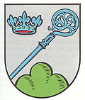

Administration Toponyme officiel Cronenberg Pays  Allemagne
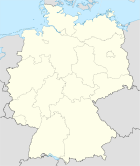
Land Rhénanie-Palatinat Arrondissement
(Landkreis)Kusel Code communal
(Gemeindeschlüssel)07 3 36 013 Code postal 67744 Indicatif téléphonique 06382 Immatriculation KUS Politique Bourgmestre
(Ortsbürgermeister)Klaus Schneider Partis au pouvoir Géographie Coordonnées Altitude (NN) 250 m Superficie 2,65 km2 Démographie Population 144 hab. (2009) Densité 54 hab./km2 modifier 
Cronenberg est une municipalité de l'arrondissement de Kusel, en Rhénanie-Palatinat, dans l'ouest de l'Allemagne.
References
- (en) Cet article est partiellement ou en totalité issu de l’article de Wikipédia en anglais intitulé « Cronenberg, Rhineland-Palatinat » (voir la liste des auteurs)
Catégorie :- Ville de Rhénanie-Palatinat


Wikimedia Foundation. 2010.