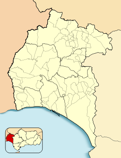
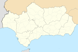
Cañaveral de León est une commune de la communauté autonome d'Andalousie, dans la province de Huelva, en Espagne.
Géographie
Relief
Cette section est vide, insuffisamment détaillée ou incomplète.
Votre aide est la bienvenue !
Géologie
Cette section est vide, insuffisamment détaillée ou incomplète.
Votre aide est la bienvenue !
Hydrographie
Cette section est vide, insuffisamment détaillée ou incomplète.
Votre aide est la bienvenue !
Climat
Cette section est vide, insuffisamment détaillée ou incomplète.
Votre aide est la bienvenue !
Toponymie
Cette section est vide, insuffisamment détaillée ou incomplète.
Votre aide est la bienvenue !
Histoire
Cette section est vide, insuffisamment détaillée ou incomplète.
Votre aide est la bienvenue !
Héraldique
Fichier:Blason Cañaveral de León.jpg
Administration
Municipalité
Cette section est vide, insuffisamment détaillée ou incomplète.
Votre aide est la bienvenue !
Liste des maires successifs
| Période |
Identité |
Étiquette |
Qualité |
| N/A |
N/A |
N/A |
N/A |
Maire |
| Toutes les données ne sont pas encore connues. |
Intercommunalité
Cette section est vide, insuffisamment détaillée ou incomplète.
Votre aide est la bienvenue !
Budget et fiscalité
Cette section est vide, insuffisamment détaillée ou incomplète.
Votre aide est la bienvenue !
Urbanisme
Cette section est vide, insuffisamment détaillée ou incomplète.
Votre aide est la bienvenue !
Démographie
Évolution démographique
Cette section est vide, insuffisamment détaillée ou incomplète.
Votre aide est la bienvenue !
Pyramides des âges
Cette section est vide, insuffisamment détaillée ou incomplète.
Votre aide est la bienvenue !
Économie
Secteur Primaire
Cette section est vide, insuffisamment détaillée ou incomplète.
Votre aide est la bienvenue !
Secteur Secondaire
Cette section est vide, insuffisamment détaillée ou incomplète.
Votre aide est la bienvenue !
Secteur Tertiaire
Cette section est vide, insuffisamment détaillée ou incomplète.
Votre aide est la bienvenue !
Culture et patrimoine
Culture
Cette section est vide, insuffisamment détaillée ou incomplète.
Votre aide est la bienvenue !
Patrimoine civil
Cette section est vide, insuffisamment détaillée ou incomplète.
Votre aide est la bienvenue !
Patrimoine religieux
Cette section est vide, insuffisamment détaillée ou incomplète.
Votre aide est la bienvenue !
Patrimoine environnemental
Cette section est vide, insuffisamment détaillée ou incomplète.
Votre aide est la bienvenue !
Équipements ou Services
Transports urbains
Cette section est vide, insuffisamment détaillée ou incomplète.
Votre aide est la bienvenue !
Éducation
Cette section est vide, insuffisamment détaillée ou incomplète.
Votre aide est la bienvenue !
Sports
Cette section est vide, insuffisamment détaillée ou incomplète.
Votre aide est la bienvenue !
Santé
Cette section est vide, insuffisamment détaillée ou incomplète.
Votre aide est la bienvenue !
Vie locale
Culte
Cette section est vide, insuffisamment détaillée ou incomplète.
Votre aide est la bienvenue !
Environnement
Cette section est vide, insuffisamment détaillée ou incomplète.
Votre aide est la bienvenue !
Personnalités liées à la commune
Cette section est vide, insuffisamment détaillée ou incomplète.
Votre aide est la bienvenue !
Voir aussi

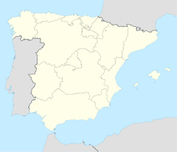
 Espagne
 Andalousie
 Province de Huelva


