- Barvinkove
-
Barvinkove Барвінкове 

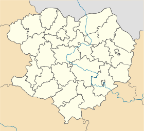
Géolocalisation sur la carte : Oblast de Kharkiv

Géolocalisation sur la carte : Ukraine
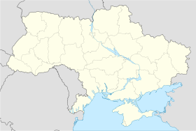
Coordonnées : Pays  Ukraine
Subdivision  Oblast de Kharkiv
Fondation 1680 Statut Ville depuis 1938 Population  10 205 hab. (2011)
Densité 519 hab./km² Superficie 19,65 km2 Indicatif tél. +380 5757 Code postal 64709 Liste des villes d'Ukraine | Carte Barvinkove (en ukrainien : Барвінкове) ou Barvenkovo (en russe : Барвенково) est une ville de l'oblast de Kharkiv, en Ukraine, et le centre administratif du raïon de Barvinkove. Sa population s'élevait à 10 205 habitants en 2011.
Sommaire
Géographie
Barvinkove est située à 132 km au sud-est de Kharkiv.
Histoire
Barvinkove a le statut de ville depuis 1938. La région de Barvinkove ou Bervenkovo fut le théâtre de violents combats pendant la Seconde Guerre mondiale. En janvier 1942, l'offensive soviétique Barvenkovo-Lozavaïa, menée par le Front Sud et le Front sud-ouest de l'Armée rouge, tenta de reprendre Kharkiv. Le 24 janvier, Barvenkovo fut reprise par la 9e Armée soviétique notamment aux dépens de la Légion Wallonie. Le colonel d'un régiment de chars, E. G. Pouchkine, s'illustra au cours de cette opération. Mais le saillant de Barvenkovo ainsi formé fut attaqué en mai 1942 par la XVIIe Armée allemande et la Première Armée Panzer. Barvenkove devint un piège pour les 6e et 57e armées soviétiques, qui ne purent briser l'encerclement et perdirent beaucoup d'hommes et de matériels. Barvenkovo fut reprise par l'Armée rouge le 10 septembre 1943.
Population
Recensements (*) ou estimations de la population [1] :
Évolution démographique 1959* 1970* 1979* 1989* 2001* 2008 2009 2010 2011 13 476 15 318 15 241 14 889 12 998 10 889 10 564 10 395 10 205 Notes et références
- (ru) Recensements de 1959, 1970 et 1979 sur www.webgeo.ru — (en) World Gazetteer [1] — (uk) Office des statistiques d'Ukraine : Статистичний збірник «Чисельність наявного населення України на 1 січня 2008 року» [Manuel statistique « Nombre d'habitants de l'Ukraine au 1er janvier 2008 »]. [2] ; Статистичний збірник «Чисельність наявного населення України на 1 січня 2010 року» [Manuel statistique « Nombre d'habitants de l'Ukraine au 1er janvier 2010 »]. [3] ; Статистичний збірник «Чисельність наявного населення України на 1 січня 2011 року» [Manuel statistique « Nombre d'habitants de l'Ukraine au 1er janvier 2011 »]. [4]
Liens externes
- (uk) Informations officielles
- (ru) Cartes topographiques
- (uk) Carte routière
Catégories :- Ville d'Ukraine
- Ville de l'oblast de Kharkiv


Wikimedia Foundation. 2010.