Bombardopolis
- Bombardopolis
-
Bombardopolis (Bonbad en créole haïtien) est une localité située à l’extrême pointe ouest de la presqu’île du Nord d'Haïti.
La commune est située dans le département du Nord-Ouest et dans l'Arrondissement de Môle-Saint-Nicolas.
Démographie
La commune est peuplée de 32 764 habitants[1](recensement par estimation de 2009).
Administration
La commune est composée des sections communales de :
- Plate-Forme
- Des Forges
- Plaine-d'Oranges
Économie
L'économie locale repose essentiellement sur la production du charbon de bois, l'élevage caprin et la pêche.
Notes et références
Liens externes
Catégories :
- Ville du Nord-Ouest (Haïti)
- Commune d'Haïti
Wikimedia Foundation.
2010.
Contenu soumis à la licence CC-BY-SA. Source : Article Bombardopolis de Wikipédia en français (auteurs)
Regardez d'autres dictionnaires:
Bombardopolis — Original name in latin Bombardopolis Name in other language Bombardopolis, Ville de Bombardopolis State code HT Continent/City America/Port au Prince longitude 19.69312 latitude 73.33296 altitude 417 Population 1974 Date 2013 08 07 … Cities with a population over 1000 database
Bombardopolis — Infobox Settlement official name = Bombardopolis nickname = native name = Bonbadopolis settlement type = motto = imagesize = image caption = flag size = image seal size = image shield = shield size = image blank emblem = blank emblem type = blank … Wikipedia
Nord-Ouest Department — Department Country Haiti Capital … Wikipedia
Môle-Saint-Nicolas Arrondissement — Môle Saint Nicolas (Creole: Mòl Sen Nikola) is an arrondissement in the Nord Ouest Department of Haiti. It has 169,238 inhabitants[1]. Postal codes in the Môle Saint Nicolas Arrondissement start with the number 33. The arondissement consists of… … Wikipedia
List of communes of Haiti — Haiti This article is part of the series: Politics and government of Haiti Constitution President (List) … Wikipedia
Haiti — Republic of Haiti République d Haïti (French) Repiblik Ayiti … Wikipedia
List of cities in Haiti — This is a list of cities in Haïti. Cities are listed by their French names, with Kréyòl names in brackets.* Bombardopolis A large town rather than a city * Cap Haïtien ( Okap or Kapayisyen ) Haïti s second largest city, with a population of… … Wikipedia
Arrondissements and communes of Haiti — Haiti is divided into 41 arrondissements, and 133 communes.Artibonite Department*Dessalines Arrondissement **Desdunes **Dessalines **Grande Saline **Petite Rivière de l Artibonite*Gonaïves Arrondissement **Ennery **Estère **Gonaïves*Gros Morne… … Wikipedia
Ouest Department — Department Country Haiti Capital … Wikipedia
Nord-Est Department — Nord Est (English: North East, Haitian Creole: Nòdès) is one of the ten departments (French: départements) of Haiti. It has an area of 1,805 km² and a population of 283,800 (2002). Its capital is Fort Liberté. It used to be part of Nord… … Wikipedia
 Haïti
Haïti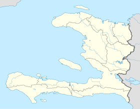
 Bombardopolis