Biggleswade
- Biggleswade
-
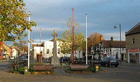
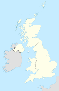
Biggleswade est une ville du Bedfordshire, en Angleterre. Au recensement de 2001, sa population était de 15 383 habitants.
Jumelage
Sur les autres projets Wikimedia :
Wikimedia Foundation.
2010.
Contenu soumis à la licence CC-BY-SA. Source : Article Biggleswade de Wikipédia en français (auteurs)
Regardez d'autres dictionnaires:
Biggleswade — (spr. Bikkelsuäd), Marktflecken in der englischen Grafschaft Bedford, am Ivel; hat 3200 Ew. u. bedeutende Kornmärkte … Pierer's Universal-Lexikon
Biggleswade — (spr. biggelsŭēd), Stadt in Bedfordshire (England), am schiffbaren Ivel, nach einem großen Brand 1785 fast ganz neu erbaut, hat Fahrradfabrikation und (1901) 5120 Einw. In der Nähe Arlesey mit schöner gotischer Kirche … Meyers Großes Konversations-Lexikon
Biggleswade — (spr. bígglswehd), Stadt in der engl. Grafsch. Bedford, am schiffbaren Ivel, (1901) 5120 E … Kleines Konversations-Lexikon
Biggleswade — infobox UK place country = England latitude= 52.0855 longitude= 0.2557 official name= Biggleswade population = 15,383 shire district= Mid Bedfordshire shire county = Bedfordshire region= East of England constituency westminster= NE Bedfordshire… … Wikipedia
Biggleswade — Original name in latin Biggleswade Name in other language State code GB Continent/City Europe/London longitude 52.08652 latitude 0.26493 altitude 32 Population 15726 Date 2011 03 03 … Cities with a population over 1000 database
Biggleswade Rural District — Biggleswade was a rural district in Bedfordshire, England from 1894 to 1974. [http://www.visionofbritain.org.uk/unit page.jsp?u id=10093260] As initially created the district entirely surrounded but did not include Biggleswade, which was an urban … Wikipedia
Biggleswade Castle — was a castle in the market town of Biggleswade in Bedfordshire (gbmapping|TL18434452).The existence of this castle was discovered by aerial photography, in 1954, which showed the remains of a motte and bailey castle with a double ditch around the … Wikipedia
Biggleswade (hundred) — infobox UK place country = England static static image caption= latitude= 52.08733 longitude= 0.26521 official name = Biggleswade population = shire district= Mid Bedfordshire shire county= Bedfordshire region= East of England constituency… … Wikipedia
Biggleswade United F.C. — Football club infobox clubname = Biggleswade United fullname = Biggleswade United Football Club nickname = United founded = 1929 (Reformed in 1959) ground = Second Meadow, Fairfield Road, Biggleswade capacity = unknown chairman = Keith Jackson… … Wikipedia
Biggleswade Town F.C. — Football club infobox clubname = Biggleswade Town fullname = Biggleswade Town Football Club nickname = The Waders founded = 1874 ground = The Carslberg Stadium, Biggleswade capacity = 2,500 chairman = Maurice Dorrington vice chairman = Jon Smith… … Wikipedia

 Angleterre
