Antanifotsy
Contenu soumis à la licence CC-BY-SA. Source : Article Antanifotsy de Wikipédia en français (auteurs)
Regardez d'autres dictionnaires:
Antanifotsy — Saltar a navegación, búsqueda Antanifotsy Archivo:Antananarivo Antanifotsy.png Mapa de la Provincia de Antananarivo mostrando la localización de Antanifotsy (rojo). Ubicación País Madagascar … Wikipedia Español
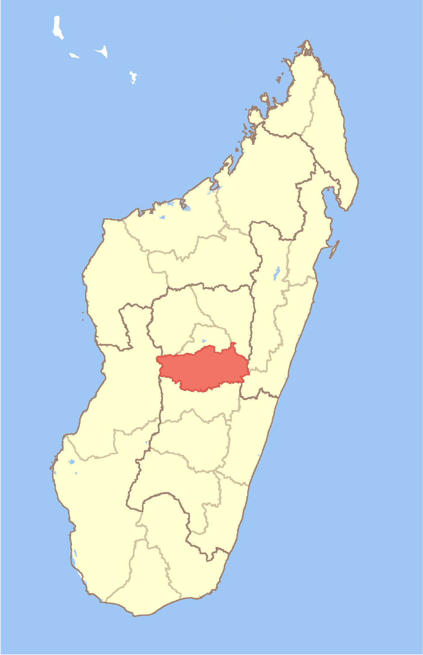
Antanifotsy — Infobox City official name = Antanifotsy mapsize = 183px map caption = Map of Antananarivo Province showing the location of Antanifotsy (red). subdivision type = Country subdivision name = Madagascar subdivision type1 = Province subdivision name1 … Wikipedia
Antanifotsy — Original name in latin Antanifotsy Name in other language State code MG Continent/City Indian/Antananarivo longitude 19.65 latitude 47.31667 altitude 1571 Population 70626 Date 2013 06 06 … Cities with a population over 1000 database
Antanifotsy — Admin ASC 2 Code Orig. name Antanifotsy Country and Admin Code MG.7670854.7670918 MG … World countries Adminstrative division ASC I-II
Antanifotsy (Soanierana Ivongo) — 16° 52′ 00″ S 49° 38′ 00″ E / 16.866667, 49.633333 … Wikipédia en Français
Antanifotsy, Soanierana Ivongo — Infobox Settlement official name = Antanifotsy other name = native name = nickname = settlement type = motto = imagesize = image caption = flag size = image seal size = image shield = shield size = image blank emblem = blank emblem type = blank… … Wikipedia
District d'Antanifotsy — Antanifotsy Région Vakinankaratra Chef lieu Antanifotsy Nombre de kaominina 11 Superficie 3 005 km … Wikipédia en Français
Ambatolahy (Antanifotsy) — 19° 44′ 00″ S 47° 17′ 00″ E / 19.733333, 47.283333 … Wikipédia en Français
Ambodiriana (Antanifotsy) — 19° 35′ 00″ S 47° 32′ 00″ E / 19.583333, 47.533333 … Wikipédia en Français
Ambohimandroso (Antanifotsy) — 19° 31′ 00″ S 47° 25′ 00″ E / 19.516667, 47.416667 … Wikipédia en Français
 Madagascar